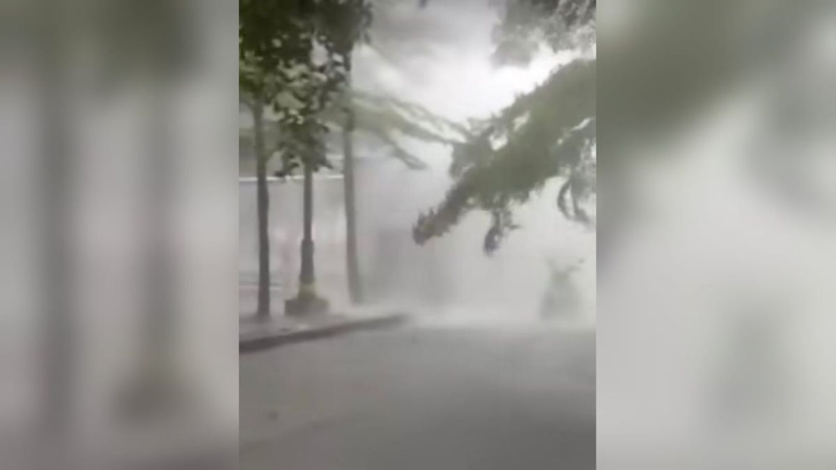
JAKARTA - Hujan tak biasa terjadi di Kawasan Stadion Wibawa Mukti, Kabupaten Bekasi, Jawa Barat, Selasa, 8 November. Dalam sebuah video yang viral di media sosial, mengunjukkan air yang turun dari huat bukan rantik-rintik, tapi seperti air pelang yang begitu deras.
Responding to this, the Senior Forecaster of the Meteorology, Climatology and Geophysics Agency (BMKG), Reifda Novikaray explained that the phenomenon in the term Meteorology is called downburst or strong winds that are vertically downward.
"So the strong wind system vertically went down and occurred in a short time which arose from the cumulonimbus type cloud system and spread when it surfaced to the ground," said Reifda in a short message received by VOI, Wednesday, November 9.
Reifda also explained that Downbrust is different from a tornado. Because this wind is more propagating and strong vertically from the bottom of the cloud. Meanwhile, the tornado is turned like a spiral or trunk that descends from the cloud to the surface.
This Downbrust has a high destructive power, because it occurs at high speeds in a short duration and is usually accompanied by rain. So when it occurs in residential areas it can cause infrastructure damage," he wrote.
"The phenomenon of downburst is quite difficult to detect and predict, it seems like a tornado, because the phenomenon occurs on a short time scale up to just a few minutes away, and is difficult to predict," he continued.
Therefore, he advised the public to see the condition of the clouds, if it looks dark to be more vigilant.
For extreme weather events including downbursts or tornadoes and weather growth of clouds that are already dark and towering, because the type of cloud can be ascertained which type of cumulonimbus can usually cause heavy rain to occur, "the lid.
The English, Chinese, Japanese, Arabic, and French versions are automatically generated by the AI. So there may still be inaccuracies in translating, please always see Indonesian as our main language. (system supported by DigitalSiber.id)
