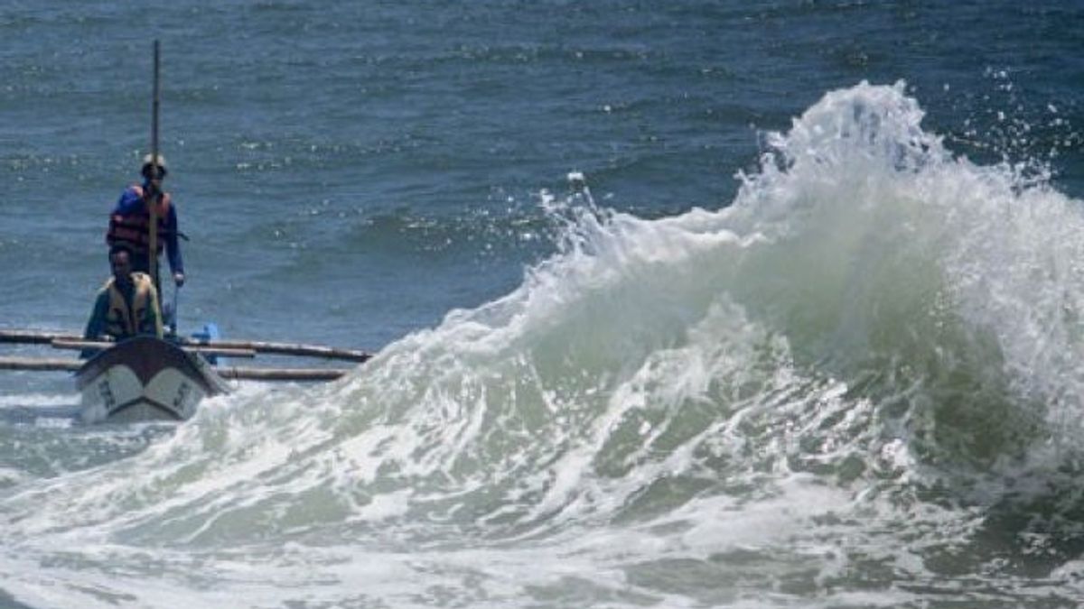
JAKARTA - The Meteorology, Climatology and Geophysics Agency (BMKG) issued an early warning of up to seven meters high waves in the North Natuna Sea.
Thus, people, especially those on the coast and fishermen, are asked to be alert to the impact of these high waves.
"The potential for extreme category waves of 6-7 meters can occur in the North Natuna Sea for the next two days," said Head of Public Relations of BMKG Akhmad Taufan Maulana in a statement received in Jakarta, reported by Antara, Friday, December 4.
There is a low pressure pattern of 1006 hPa in the Indian Ocean southwest of Banten and the Flores Sea. Wind patterns in Indonesia generally move from west-north with speeds ranging from 5-25 knots.
The highest wind speeds were observed in the North Natuna Sea, the northern waters of the Natuna Islands-Anambas Islands, the western waters of Lampung, the western and southern parts of the Sunda Strait. This condition results in wave height around the area.
According to BMKG monitoring, the potential for very high waves ranging from 4-6 meters is likely to occur in the northern waters of the Anambas Islands-Natuna Islands.
Meanwhile, waters with high wave potential, reaching 2.5 - 4 meters, are likely to occur in several other Indonesian waters, including the northern part of the Malacca Strait, the northern waters of Sabang, the waters of the Subi-Serasan Islands, the southern waters of the Anambas Islands-Natuna Islands, the sea Natuna.
The same condition is likely to occur in the western waters of Enggano Island, the western waters of Lampung, the western Indian Ocean, the Mentawai Islands - Lampung, the western and southern parts of the Sunda Strait, the southern waters of Java - Lombok and the Indian Ocean south of Java - NTB.
Meanwhile, several other waters have the potential for waves with moderate height, namely 1.25 - 2.5 meters, namely Sabang waters - Banda Aceh, western waters of Aceh, western waters of Simeulue Island-Mentawai Islands, Bengkulu coastal waters, Lampung Bay. southern part, western Indian Ocean Aceh-Nias Islands, Bali-Lombok Strait - southern Alas, southern Sape Strait, southern waters of Sumbawa-Savu Island, southern Savu Sea.
Also in the western part of the Sumba Strait, the southern Indian Ocean of NTT, the eastern waters of the Bintan Islands-Lingga Islands, the Karimata Strait and the Galasa Strait, the northern waters of the Bangka-Belitung Islands, the Java Sea, the southern waters of Central Kalimantan, the eastern Flores Sea, the eastern and southern waters Wakatobi Islands, northern waters of Sangihe Islands-Talaud Islands, Halmahera Sea, northern and eastern waters of Halmahera Islands, northern waters of West Papua-Papua, North Pacific Ocean Halmahera-Papua.
The potential for high waves in some of these areas can pose a risk to shipping safety. For this reason, BMKG always urges the public to always be vigilant, especially for fishermen and people who live and do activities on the coast around areas where high waves are likely to occur to stay alert.
The English, Chinese, Japanese, Arabic, and French versions are automatically generated by the AI. So there may still be inaccuracies in translating, please always see Indonesian as our main language. (system supported by DigitalSiber.id)
