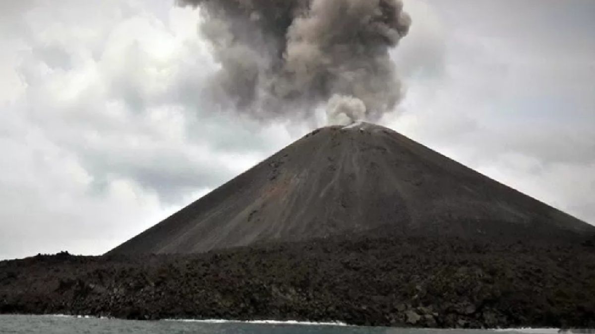


LAMPUNG - The Center for Volcanology and Geological Hazard Mitigation (PVMBG) of the Geological Agency of the Ministry of Energy and Mineral Resources asked the public to avoid a five-kilometer radius from the active crater of Mount Anak Krakatau following the height of the volcanic ash eruption column that had reached 2,000 meters.
The Head of the Bureau of Communication, Public Information Services, and Cooperation (KLIK) of the Ministry of Energy and Mineral Resources, Agung Pribadi, asked the public not to move in areas of potential danger.
He also asked to be aware of the dangers of lahars, especially when it rains around Mount Anak Krakatau.
"According to the PVMBG report, in connection with the high movement of Mount Anak Krakatau's activity, we recommend that people are not allowed to approach Mount Anak Krakatau within a five km radius of the active crater," Agung said in his statement, Tuesday, July 19.
Volcanic activity accompanied by the eruption of Mount Anak Krakatau has continued to increase since the last four days.
These observations were recorded on a seismograph belonging to the PVMBG Geological Agency of the Ministry of Energy and Mineral Resources. On Monday, July 18, at 08.26 WIB, the height of the eruption column reached 2,000 m above the summit with a maximum amplitude of 53 mm and a duration of 127 seconds.
In observing the earthquake, Agung continued, Mount Anak Krakatau experienced six harmonic tremors with an amplitude of 12-17 mm, five low frequency earthquakes, and two shallow volcanic earthquakes lasting 10-12 seconds.
Then there was one volcanic earthquake with a duration of 25 seconds, and one continuous tremor with an amplitude of 0.5-25 mm (dominantly two mm).
Agung also conveyed that the first eruption of Mount Anak Krakatau occurred on Saturday, July 16, at 22:55 WIB, accompanied by an observed eruption column height of 1,500 m above the peak with a maximum amplitude of 50 mm for 29 seconds.
It was continued, at 23.39 WIB with an eruption height of 1,500 m above the peak. One day later, Anak Krakatau erupted again with a height of 2,000 m above the peak for 79 seconds.
Historically, according to Agung, the potential danger of landslides in the body of Mount Anak Krakatau is a permanent hazard that needs to be monitored and anticipated primarily by the competent authorities in early warning of volcanic eruptions such as tsunamis.
"Volcanic landslides cannot be predicted when they occur and their volumes do not depend on whether or not they are erupting. Volcanic avalanches can occur with or without an increase in volcanic activity," he said.
Therefore, he also asked the public to comply with the recommendations issued by the Geological Agency of the Ministry of Energy and Mineral Resources through the PVMBG, and not to be provoked by false and irresponsible news regarding the activities of Mount Anak Krakatau.
Also, always follow the directions of the authorized agency, namely the Geological Agency which will continue to coordinate with BNPB and ministries/agencies, regional governments, and other relevant agencies.
Information on volcanic activity in Indonesia, earthquakes, and the latest ground movements can be obtained through the Magma Indonesia application or the www.vsi.esdm.go.id or magma.esdm.go.id page, and PVMBG social media (Facebook, Twitter, and Instagram pvmbg).
The English, Chinese, Japanese, Arabic, and French versions are automatically generated by the AI. So there may still be inaccuracies in translating, please always see Indonesian as our main language. (system supported by DigitalSiber.id)


