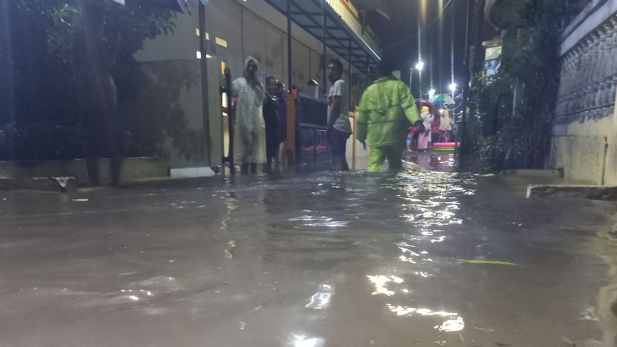


TANGERANG - As many as 8 areas in Tangerang were inundated by floods due to extreme rain with high intensity that occurred on Tuesday, May 10, evening. The highest recorded altitude is in the Gembor area, Periuk, Tangerang City, which is 1 meter.
Head of the Emergency and Logistics Division of the Tangerang City BPBD Ghufron Falveli said the data was based on reports received as of Wednesday, May 11, at 01.30 western Indonesia time.
"There are eight points that experienced inundation and flooding. The highest altitude is in Gembor, Periuk, Tangerang City, approximately 1 meter," said Ghufron when confirmed, Wednesday, May 11.
SEE ALSO:
-
 | BERITA
Menteri PPPA Bintang Puspayoga Segera Susun Peraturan Pascapengesahan RUU TPKS
13 April 2022, 14:53


The following are the locations of eight points that were flooded in Tangerang City:
1. Bumi Mas Raya Street, Cikokol, Tangerang District (appears at 00.22 western Indonesia time, the flood height is approximately 1 meter)
2. Royal Park 3, Poris Plawad, Cipondoh District (appears at 00.30 western Indonesia time, the inundation height is approximately 40 centimeters)
3. Mutiara Pluit, Periuk District (appears at 00.47 western Indonesia time, the inundation height is approximately 40cm)
4. Sinar Hati Street, Sukajadi, District Karawaci (appears at 00.47 western Indonesia time, the inundation height is about 40cm)
5. Cimone Alfa Raya Street Number 1, RT06/RW07, Cimone, District Karawaci (appears at 01.08 western Indonesia time, the inundation height is about 40cm)
6. Alamanda Bridge, Gembor, Periuk District (appears at 01.08 western Indonesia time, flood height is about 1 meter)
7. Below the Cibodas Park Flyover (appears at 01.22 western Indonesia time, the flood height is about 1 meter)
8. Cimone Mas Permai, RW05 (appears at 01.20 western Indonesia time, the inundation height is about 60 centimeters)
The English, Chinese, Japanese, Arabic, and French versions are automatically generated by the AI. So there may still be inaccuracies in translating, please always see Indonesian as our main language. (system supported by DigitalSiber.id)


