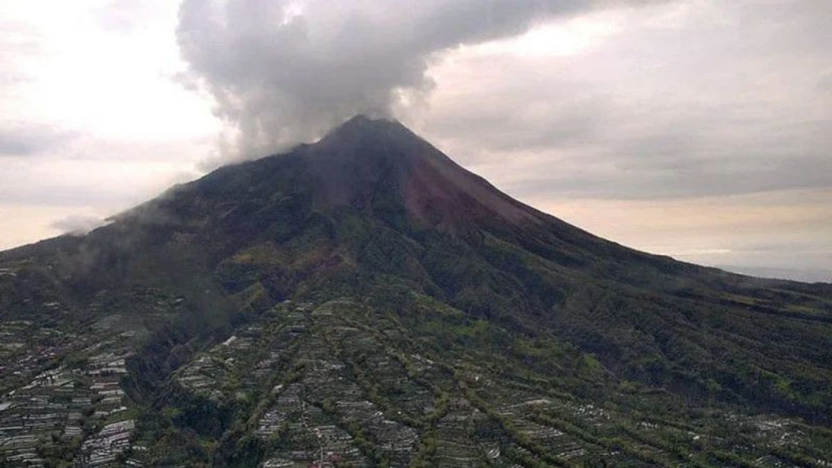


SLEMAN - Mount Merapi experienced 96 avalanches of earthquakes on Thursday, April 21, at 00.00-24.00 WIB. During the observation period, one tectonic earthquake was recorded and three multiphase earthquakes were recorded.
Data from the Geological Disaster Technology Research and Development Center (BPPTKG) said white smoke with a height of up to 100 meters came out of Mount Merapi on the border of DI Yogyakarta and Central Java.
Head of BPPTKG Hanik Humaida said that during the observation period, 18 lava avalanches were recorded from the mountain with a maximum sliding distance of 2,000 meters to the southwest.
The deformation or changes in Merapi's body shape monitored by BPPTKG using electronic distance measurement (EDM) is an average of 0.2 cm per day (within 3 days).
Meanwhile, referring to the latest data from BPPTKG, the volume of the lava dome in the southwest is recorded at 1,672,000 cubic meters and the volume of the middle dome is 2,582,000 cubic meters.
Continuing Antara's report, until now BPPTKG still maintains the status of Mount Merapi at Level III or Standby.
Lava flows and hot clouds from Mount Merapi can impact areas in the south-southwest sector which include the Boyong River (a maximum of five kilometers) and the Bedog, Krasak, Bebeng rivers (a maximum of seven kilometers).
In addition, lava flows and hot clouds from Mount Merapi can impact areas in the southeastern sector which include the Woro River (a maximum of three kilometers) and the Gendol River (a distance of five kilometers).
Hanik Humaida said, if the volcano experienced an explosive eruption, the ejection of volcanic material could reach areas within a radius of three kilometers from the top of the mountain.
The English, Chinese, Japanese, Arabic, and French versions are automatically generated by the AI. So there may still be inaccuracies in translating, please always see Indonesian as our main language. (system supported by DigitalSiber.id)
Most Popular Tags
#Prabowo Subianto #donald trump #2026 World Cup #bgn #konflik timur tengahPopular


