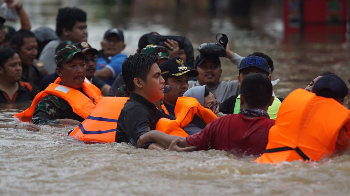


JAKARTA - Heavy rain that flushed Jakarta on New Year's Eve, causing 130 points throughout Jabodetabek to be flooded. The flood this time is also known as one of the biggest floods in Jakarta and its surroundings.
Deputy Minister (Wamen) Environment and Forestry (LHK) Alue Dohong explained that the floods that inundated Jakarta and its surroundings were caused by many factors. One of them, reduced water absorption sources.
"Yes, there are many factors, the rainfall is also high. Then some of the soil infiltration has also decreased," he said, when met at the Ministry of Environment and Forestry Office, Manggala Wanabakti Building, Gatot Subroto, West Jakarta, Monday, January 6.
It is not only the source of water infiltration that is reduced. Based on data from the Geological Agency of the Ministry of Energy and Mineral Resources, it was noted that by 2013 the land surface in Jakarta had fallen 40 meters from its origin, especially in northern Jakarta, which had accumulated since decades ago.
Even so, the level of land subsidence in Jakarta had experienced improvement around 2013 to 2018. This can be seen from the volume of soil density that was successfully suppressed to the range of 35 meters in 2018.
From the results of monitoring with GPS Geodetic, the rate of land subsidence in North Jakarta reaches 12 cm each year. If left unchecked, it is not impossible that Jakarta will literally sink.
Currently Jakarta is experiencing the phenomenon of land subsidence, a term that is defined as an event of land subsidence. In the worst case, land subsidence can cause the land surface to sink. This makes the city of Jakarta experience a periodic subsidence of land surface, which currently reaches 12 cm per year in North Jakarta.
Massive development in Jakarta has not only reduced water absorption sources. However, it also contributes to the rate of land subsidence. This factor has contributed to the worst flooding that hit Jakarta and its surroundings some time ago.
Not only Jakarta, the source of water respiration in Puncak, Bogor and Depok has also decreased. The lack of water infiltration is due to the large number of buildings standing along the watershed (DAS).
"The source of infiltration is reduced. Because there are many buildings and so on. Also there is a lack of public awareness (about the environment)," he explained.
Jakarta is in the lowest position after Bogor and Depok. To avoid flooding in Jakarta, which is the lowest level of land, said Alue, land improvement must also be carried out in the upstream part.
"What is clear is that the curbing violates the forest area. It also needs law enforcement. So, especially in the Puncak areas which should be from the water catchment area for landslide prevention and so on," he explained.
According to him, there must be coordination between the regional and central governments in anticipating flooding. In addition, it is also to look for common problems.
"There must be that. Coordination first identifies problems with space users, and adds forest areas," he explained.
As is well known, the government through the PUPR Ministry is carrying out strategic projects, namely the Ciawi and Sukamahi Dam. The two dams are expected to be completed quickly in order to cope with flooding in Jakarta.

Normalization or Naturalization that is suitable to be applied in Jakarta?
Alue admitted that he did not want to dichotomize the two concepts. Because, according to him, both naturalization and normalization are good concepts. However, it must be supported by the social sector.
"I don't want to dichotomize between naturalization and normalization. As long as the two approaches work well and are suitable, that's okay. This means that the physical approach must be supported by social," he said.
In addition, Alue also reminded that there is no need to debate which is the best of the two concepts to be applied in Jakarta. According to him, in applying the concept of normalization or naturalization of rivers or rivers, it must also be seen from the characteristics of the area.
"We must not divide those two things. It means that whatever efforts are made it is necessary. If the areas that can be normalized are normalized, the areas that should be naturalized are the areas that have naturalized peaks," he explained.
The English, Chinese, Japanese, Arabic, and French versions are automatically generated by the AI. So there may still be inaccuracies in translating, please always see Indonesian as our main language. (system supported by DigitalSiber.id)
Most Popular Tags
#Prabowo Subianto #donald trump #2026 World Cup #venezuela #konflik timur tengahPopular


