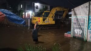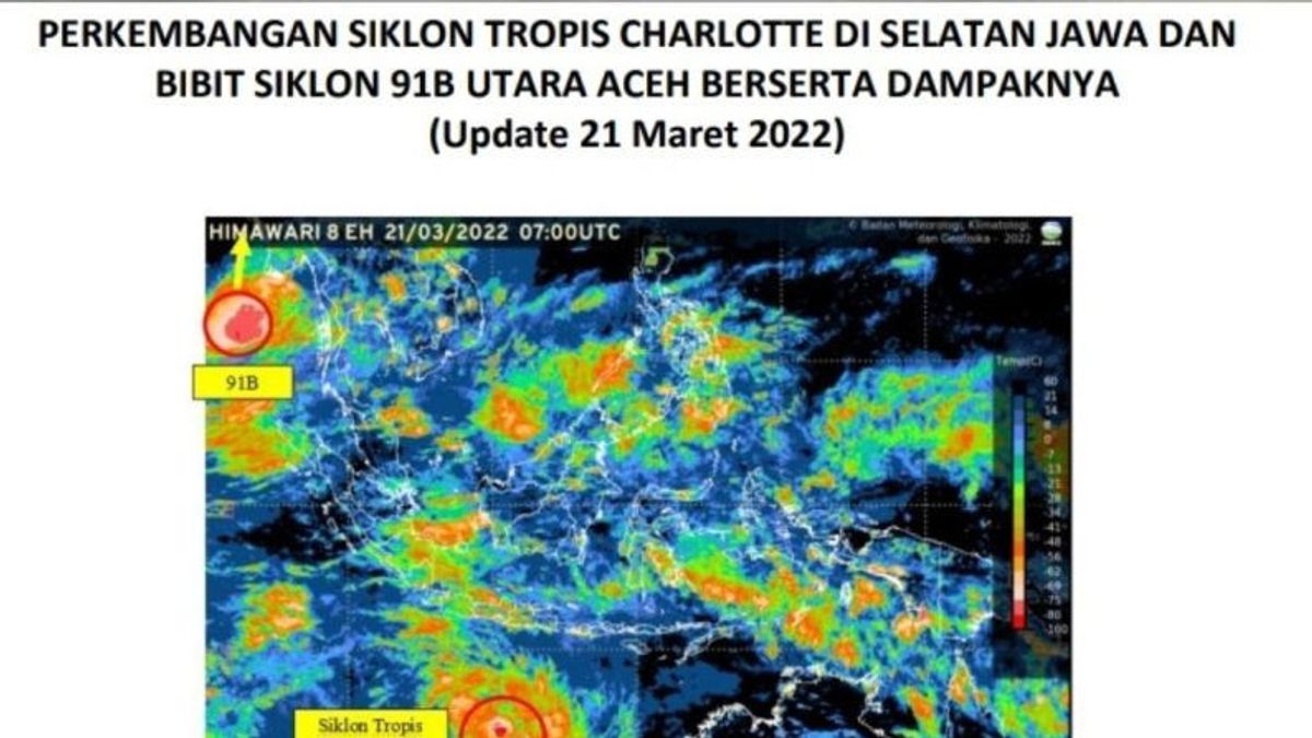


JAKARTA - The Meteorology, Climatology and Geophysics Agency (BMKG) reported that Tropical Cyclone Charlotte was observed in the Indian Ocean south of Central Java with a maximum wind speed of 55 knots and a low pressure of 985 HPa.
In the InfoBMKG Youtube channel followed in Jakarta, Tuesday, March 22, the cyclone system is moving southwest away from Indonesian territory and it is estimated that its intensity will decrease in the next 24 hours.
He explained, this system induces an increase in wind speed or low-level jets to reach more than 25 knots in the Indian Ocean south of East Java to West Java, and forms a long convergence area from the Indian Ocean to the Southwest of Banten to the southern waters of West Java.
Quoted by Antara, this condition is able to increase the growth of rain clouds, wind speed, and sea wave heights around the tropical cyclone area and along the low-level jet area.
Cyclonic circulation was observed in the Arafuru Sea and in the northern waters of Papua, which formed a longitudinal convergence area in the Arafuru Sea and the North Pacific Ocean of Papua.
The convergence area was also observed extending from the northern waters of Aceh to the Andaman Sea, from the eastern Java Sea to the Bali sea, from the eastern waters of North Kalimantan to North Kalimantan, from the waters of the Sangihe Talaud archipelago to Halmahera, on Seram Island from the Banda Sea to southern Papua. from northern West Papua to West Papua and central Papua.
SEE ALSO:
-
 | BERITA
Ini Ida Adik Jokowi yang akan Menikah dengan Ketua MK Anwar Usman Mei Mendatang
21 Maret 2022, 19:41 -
 | BERITA
MK Belum Temukan Alasan untuk Ubah Presidential Threshold 20 Persen
24 Februari 2022, 13:33

This condition is able to increase the growth of rain clouds around the cyclonic circulation area and along the convergence area.
On the island of Sumatra, in general the weather conditions are cloudy to light rain, except for the Jambi area, which has the potential for fog, and be aware of the potential for thunderstorms to occur in Aceh.
Then in Java, in general, light rain, except for the Surabaya and Bandung areas, it has the potential for moderate rain.
Meanwhile, on the island of Borneo, the weather conditions are generally cloudy to light rain.
For the areas of Bali and Nusa Tenggara, the potential for light rain is expected in Kupang. Be aware of the potential for heavy rain that is expected to occur in Mataram, and thunderstorms that are expected to occur in Denpasar.
In the Sulawesi region, it is generally expected to be cloudy to light rain, except for the Gorontalo area with the potential for moderate rain.
Be aware of the potential for heavy rain that is expected to occur in Mamuju, and thunderstorms that are expected to occur in Palu and Manado.
Finally, in the easternmost region of Indonesia, in general the weather conditions are cloudy to light rain, for the Manokwari region there is the potential for moderate rain.
The English, Chinese, Japanese, Arabic, and French versions are automatically generated by the AI. So there may still be inaccuracies in translating, please always see Indonesian as our main language. (system supported by DigitalSiber.id)
Most Popular Tags
#Prabowo Subianto #golkar #Pilkada Dki #online gambling #Mount Lewotobi malePopular