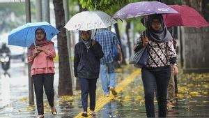
JAKARTA - The government has a strategy to block the rain to reduce the sorrow of residents so as not to experience prolonged flooding in Jabodetabek. You do this by modifying the weather on the moving clouds in the area.
The Agency for the Assessment and Application of Technology (BPPT) will minimize the clouds moving from the direction of Lampung, the Sunda Strait, to Java. This is because the flow of wet air from East Africa is expected to go to Indonesian territory and could result in the potential for extreme rain in mid-January.
"This weather modification will drop clouds moving towards Jabodetabek to be dropped throughout the northwestern part of Jabodetabek. Especially in Lampung and the Sunda Strait," said Head of the BPPT Weather Modification Technology Center Tri Handoko Seto at Graha BNPB, East Jakarta, Thursday, January 2.
"Now, the condition of Jabodetabek is very wet, there are lots of puddles everywhere. If there is heavy rain, this will certainly add to our suffering," he continued.
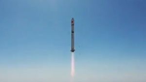
To realize the prevention of extreme weather, Seto will use 2 units of Cessna type CN295 aircraft.
Currently, BPPT is still preparing to operate the aircraft. At the latest, tomorrow morning the cloud-blocking aircraft can be flown.
"Our task is to drop the cloud, so that the rainfall in Jabodetabek will decrease significantly. Our target is to reduce 30-50 percent of the rain that will roughly fall in Jabodetabek," he said.
As is known, the Head of the Meteorology, Climatology and Geophysics Agency (BMKG) Dwikorita Karnawati estimates that the potential for heavy rain at the beginning of the year will still last for the next seven days.
"The potential for heavy rain from 2 to 7 January in Jabodetabek," said Dwikorita.
Weather forecasts that occur in Jabodetabek, on average, start from cloudy mornings, rainy afternoons and evenings. Even though it has been predicted, the weather can change at any time due to weather anomalies.
Then, the movement of wet air flow will also continue in late January to mid February 2020.
"The flow of wet air into Indonesia is estimated to be on February 10-15, 2020 and the cycle will repeat at the end of January to mid February 2020," said Dwikorita.
Furthermore, a number of areas in Indonesia that are predicted to be affected by rains with high to extreme intensity include central Sumatra, Java, southern Kalimantan, southern to southeastern Sulawesi.
The English, Chinese, Japanese, Arabic, and French versions are automatically generated by the AI. So there may still be inaccuracies in translating, please always see Indonesian as our main language. (system supported by DigitalSiber.id)


