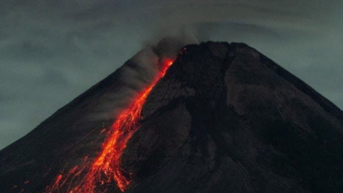


YOGYAKARTA - The Yogyakarta Geological Disaster Technology Research and Development Center (BPPTKG) recorded 10 incandescent lava avalanches coming out of Mount Merapi.
Head of BPPTKG Yogyakarta Hanik Humaida said the lava avalanche was recorded to the southwest as far as 1,700 meters starting at 00.00-06.00 western Indonesia time.
"It was observed that 10 times incandescent lava fell, the maximum sliding distance was 1,700 meters to the southwest," he said, as quoted by Antara, Wednesday, January 5.
Based on the latest seismic data, the mountain experienced 59 avalanches with an amplitude of 3-23 mm for 20.9-179.4 seconds, and one gust earthquake with an amplitude of 3 mm for 20.6 seconds, and eight multiphase earthquakes with an amplitude of 3-10 mm for 5.8-8.6 seconds.
He said that one sound was heard from the Mount Merapi Observation Post (PGM) Babadan during the observation period from 12.00-18.00 western Indonesia time.
Referring to BPPTKG data, the volume of the southwest dome of Merapi as of December 24, 2021, is 1.65 million cubic meters with the latest growth rate of 5,000 cubic meters per day.
The middle dome reaches three million cubic meters with a recent growth rate of 2,000 cubic meters per day.
SEE ALSO:
-
 | BERITA
Luncurkan Vaksinasi Merdeka Anak, Kapolri Singgung Antisipasi Penularan saat PTM
05 Januari 2022, 12:25


Until now, BPPTKG still maintains the status of Mount Merapi at Level III or Alert.
The lava fall and hot clouds of Mount Merapi are estimated to have an impact on the southeast-southwest sector for a maximum of three kilometers to the Woro River and five kilometers to the Gendol, Kuning, Boyong, Bedog, Krasak, Bebeng, and Putih rivers.
If the volcano experiences an explosive eruption, the ejection of volcanic material can reach an area within a radius of three kilometers from the top of the mountain.
The English, Chinese, Japanese, Arabic, and French versions are automatically generated by the AI. So there may still be inaccuracies in translating, please always see Indonesian as our main language. (system supported by DigitalSiber.id)
Most Popular Tags
#Prabowo Subianto #donald trump #2026 World Cup #Febrie Adriansyah #8791Popular


