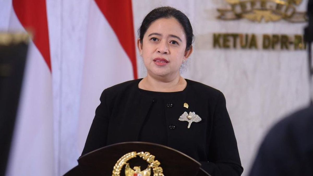


JAKARTA - The Indonesian government through the Geological Agency of the Ministry of Energy and Mineral Resources (ESDM) will dispatch a team of experts to update the map of the Mount Semeru Disaster-Prone Area in East Java. The chairman of the DPR RI, Puan Maharani, asked the public to comply.
The Geological Agency team who was at the disaster-affected location took pictures with a drone to get the latest picture of the crater openings leading to the south and southeast.
"We will continue to carry out this activity for the next few days, especially around the crater openings to the south and southeast," said Head of the Center for Volcanology and Geological Hazard Mitigation, Andiani, in a statement quoted in Jakarta, Thursday.
Andiani revealed that the Geological Agency will deploy experts to conduct mapping and research for initial identification in updating the map of the disaster-prone area of Mount Semeru.

The Geological Agency will also dispatch a team to conduct mapping in order to update the map of disaster-prone areas next week. "This is a concern for the Geological Agency, so that we will deploy many experts, ranging from environmental geologists to disaster experts, all of them will be deployed, around 10-15 people. We will all go out," said Andiani.
She also appealed to the maps issued by the Geological Agency, including maps of disaster-prone areas, to be used as a reference so that the public understands the geological character of a place, because what is depicted on the map is a prediction.
"The description in the geological map never breaks a promise. So, please use the maps that have been issued by the Geological Agency really as a reference, because the map tells a lot," concluded Andiani.
Meanwhile, Secretary of the Geological Agency, Ediar Usman, added that environmental planning geologists will help map out which areas can no longer be used as a place to live as well as provide recommendations for areas that are safe for housing.
"Of course, a safe area will be chosen and the availability of adequate groundwater for life in the future," he said.
SEE ALSO:
-
 | BERITA
Gunung Semeru Erupsi, Puan Maharani Minta Prioritaskan Penyelamatan Warga
05 Desember 2021, 00:04 -
 | BERITA
BNPB Berkoordinasi dengan Kementerian PUPR Pulihkan Dampak letusan Gunung Semeru
06 Desember 2021, 14:59 -
 | BERITA
Ada Program LITTLe Ku dan I-POINTS dari IDAI, Ini Penjelasan Piprim Basarah Yanuarso
02 Desember 2021, 13:56 -
 | BERITA
Azis Syamsuddin Didakwa Suap Bekas Penyidik KPK Robin Rp3,619 Miliar
06 Desember 2021, 12:44

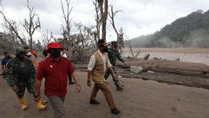
The government reminded the public to stay away from areas where hot clouds flow from avalanches because there is still the potential for secondary eruptions.
On Tuesday (6/12), the Geological Agency noted that there were four hot avalanches with a distance of 2,800 to 3,000 meters from 00.00 to 23.59 western Indonesia time.
Then observations last Wednesday, December 8, from 00.00 to 06.00 western Indonesia time, reported that there were no hot clouds falling, but vibrations from the surface were still observed.
Follow Recommendations
The Mount Semeru area is still prone to aftershocks, therefore Puan Maharani advises the public to be vigilant. She also appreciated the various groups that reached out to help residents affected by the eruption of Mount Semeru.
"The government together with the ranks of BNPB, Basarnas, TNI/Polri have worked quickly in carrying out emergency responses. We also thank the participation of various elements of society who continue to come to provide assistance," said DPR RI Speaker Puan Maharani, Tuesday, December 7.
")
Puan reminded the government to prepare proper evacuation so that residents feel safe and comfortable. “The needs of the affected people must be a priority. Provide a public kitchen so that the food needs of refugees are guaranteed. Other logistics such as blankets, bedding for sleeping, to the availability of water and electricity must also be considered," said Puan.
“Cooperation from stakeholders, particularly related ministries, local governments, and the joint SAR team, is expected to accelerate the disaster management process. People in a disaster should not feel left out by the state at all," said Puan.
Regarding the PVMBG's recommendation for the volcanic activity of Mount Semeru, the Chairperson of the Indonesian House of Representatives, Puan Maharani, appealed to the public to obey it. Among them are not to do activities within a radius of 1 km from the crater or peak of Mount Semeru and a distance of 5 km to the direction of the crater opening in the southeast - south sector, as well as being aware of hot clouds avalanches, lava and lava flows along rivers or valleys that originate at the peak of Mount Semeru," said Mrs. Puan.
Another recommendation from PVMBG is for people to stay away from or not to do activities in areas affected by hot cloud material because the temperature is still high. Then the community needs to be aware of the potential for slides along the valley of the Besuk Kobokan hot cloud path, and the need to be aware of the threat of lahars in the river channel or valley that originates in Mount Semeru. This is due to the large amount of volcanic material that has been formed.
The English, Chinese, Japanese, Arabic, and French versions are automatically generated by the AI. So there may still be inaccuracies in translating, please always see Indonesian as our main language. (system supported by DigitalSiber.id)
Most Popular Tags
#Prabowo Subianto #donald trump #2026 World Cup #Febrie Adriansyah #8791Popular


