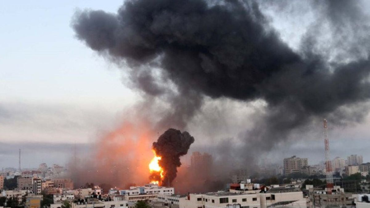


JAKARTA - Israel's days-long attack on the Gaza Strip led to a story about Google Maps. The satellite imagery feature shows the Gaza Strip in a blurry state. The researchers investigated this condition, given the importance of satellite imagery in these conditions. It is said that the US had made a policy about satellite imagery. How does that affect?
The researchers used open-source information and a variety of other publicly available data, including mapping data. All sources were combined to determine the location of the attack and document the destruction in the area.
"The fact that we are not getting high-resolution satellite imagery of Israeli and Palestinian territories hinders our work", said Samir, an open-source investigator, quoted by the BBC, Wednesday, May 19.
Monitoring Google Earth, large parts of Israel and Palestine are visible in low-resolution satellite imagery, which makes it very difficult to even see the cars in Gaza City. Compared to satellite imagery showing North Korea's capital, Pyongyang, for example, the region is clear.
Not just a car. Pyongyang satellite imagery shows individual human forms clearly. We can even distinguish one person from another.


What is the importance of satellite imagery in conflict situations?
In conflict situations, satellite imagery is an important element in reporting. When the latest confrontation broke out between Israel and Palestine, many independent investigators tried to confirm the location of the missile fire and the buildings that were the target of attacks, both in Gaza and Israel.
Investigators use satellites to do this. "The most recent imagery on Google Earth is from 2016 and looks really ugly", said the collective journalist from Bellingcat who investigated the event, Aric Toler.
"I enlarged the image of several randomly selected rural areas in Syria, and there have been more than 20 images taken since then, in very high resolution", he added in a Twitter tweet.
I know this is the least of the issues going on in Gaza now, but it's absurd that Google (and Bing, and even Yandex) refuse to provide non-potato satellite imagery for some of the most densely populated places on earth, and are regularly hit by Israeli airstrikes. pic.twitter.com/c6DtcYXYvr
- Aric Toler (@AricToler) May 11, 2021
Google actually said it would "update (image) densely populated places regularly". But that doesn't happen in the Gaza Strip.
Is there really US interference?
Last year the United States Government restricted satellite imagery to Israeli and Palestinian territories. Restrictions are for US companies on a commercial basis.
These restrictions are regulated in the Kyl-Bingaman Amendment (KBA), a legal product created in 1997 to support the security interests of the state of Israel. Under KBA rules, satellite image providers in the US are only permitted to provide low-resolution imagery, with a pixel size of not less than 2m (6ft 6in).
What happened? As an illustration, that adjustment makes an object the size of a car appear less obvious. In international policy, military bases are usually obscured.

But, apart from the US and its KBA, no country has ever intervened - in this case, to make a law - in this matter. However, the policy was shaky.
When the French company Airbus enters the US, the authorities are under pressure to provide high-resolution satellite imagery. In 2020, the US repealed the KBA Act.
Now the US government allows US companies to provide high-resolution satellite imagery. The size of each pixel can now be up to 40 cm in size, allowing human-sized objects to be clearly seen.
"The initial motivation was scientific", said Michael Fradley, an archaeologist at the University of Oxford and an academic who campaigned for the amendments to be changed.
"We want to have a consistent data source for our project, so we need access to a high resolution in the Occupied Palestinian Territories that is comparable to what we use in other parts of the region".
Then what happens?
If the KBA Law has been repealed, why is the Gaza Strip still fleeing? According to a BBC report confirming to Google, it is said that the image they display comes from multiple service providers.
Google also cites plans to update satellite imagery when it is possible for them to display higher resolutions. Even so, Google said the plan would not be carried out soon.
"Given the importance of current events, I don't see any reason the commercial image of the region should continue to be low-resolution", said Nick Waters, an open-source investigator for Bellingcat.
Maxar and Planet Labs are two companies that produce high-resolution imagery for Israel and Gaza. Maxar said it was the result of "recent changes to US regulations ... The imagery of Israel and Gaza is provided in a 0.4m (40cm) resolution", Maxar said in a press statement.
Meanwhile, Planet Labs confirmed to supply imaging in a resolution of 50cm. But open-source investigators rely heavily on free mapping software and often don't have access to the high-resolution imagery that Maxar or Planet Labs provides.
Mapping conflict areas
In 2017, human rights activists from Human Rights Watch teamed up with Planet Labs to demonstrate the condition of villages inhabited by the Rohingya ethnic group in Myanmar. From this observation, the researchers found out how much the impact of the devastation caused by the Myanmar military in these areas.
Imaging allowed researchers to map the scale of the damage that occurred in more than 200 villages. You do this by comparing the 40cm resolution satellite imagery of the area before and after the destruction.
The evidence compiled is by the confessions of Rohingya people who fled from Myanmar to Bangladesh. At that time the Rohingya refugees said they had fled because they had become military targets.
Satellite imagery also plays an important role in the case of ethnic Uighurs in Xinjiang, China. Satellite imagery shows a 're-education' center built for ethnic Uighurs.
* Read other information about ISRAEL-PALESTINA or read other interesting writings from Ahmad Fauzi Iyabu and Yudhistira Mahabharata.
BERNAS Others
see_also]
- https://voi.id/bernas/52316/sepak-terjang-hussam-abu-harbeed-komandan-militan-palestina-yang-tewas-dalam-serangan-udara-israel
- https://voi.id/bernas/52100/sialnya-jadi-kurir-pengiriman-paket-tanggung-jawab-besar-tapi-perlindungan-hukum-minim
- https://voi.id/bernas/52361/perkembangan-ajang-kecantikan-internasional-dulu-monopoli-wanita-cantik-kini-untuk-pria-dan-transgender
- https://voi.id/bernas/52391/i-digital-apartheid-i-cara-sistematis-israel-membungkam-suara-pembebasan-palestina-lewat-media-sosial
- https://voi.id/bernas/52093/ada-alasan-mengapa-orang-ngotot-mudik
The English, Chinese, Japanese, Arabic, and French versions are automatically generated by the AI. So there may still be inaccuracies in translating, please always see Indonesian as our main language. (system supported by DigitalSiber.id)


