

JAKARTA - The Central Management of the Indonesian Association of Geologists (IAGI) released five strategic recommendations addressed to the Ministry of Energy and Mineral Resources (ESDM) and the Ministry of Agrarian and Spatial Planning/National Land Agency (ATR/BPN).
This step was taken to encourage tighter integration of geoscience data in the licensing and spatial planning system to face the threat of geohidrometeorological disasters.
The Chairman of IAGI, STJ Budi Santoso emphasized that disaster technical data should no longer be merely a supplementary document, but must become a binding legal instrument in every development decision-making process.
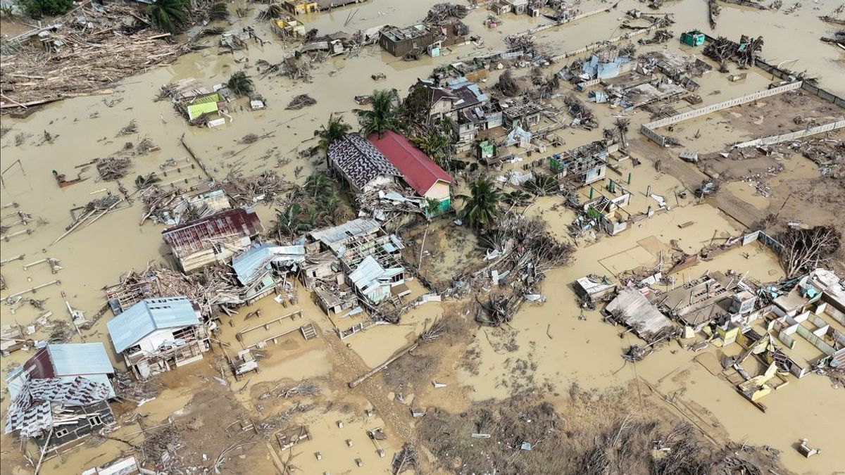
"In practice, the map (geological hazard map) is often treated only as a supporting document or an appendix to recommendations, so that its attraction is weaker than the spatial plan or other development interests. This condition causes areas with high vulnerability levels (red zones) to continue to be used for development activities," said Budi in a strategic recommendation document issued by the IAGI Central Management, Thursday, February 5.
IAGI recommends to the Ministry of Energy and Mineral Resources and the Ministry of ATR/BPN five steps to strengthen disaster mitigation based on geoscience.
First, the government is asked to implement mandatory overlay of Disaster Data by requiring that the Hazard Zone Map of Land Movement (ZKGT) compiled by the Center for Volcanology and Geological Hazard Mitigation (PVMBG) be integrated in a binding manner into the OSS and all RTRW documents at the national, provincial, and district/city levels.
Second, IAGI encourages the strengthening of integration and synergy across ministries/institutions through the integration of disaster geospatial data, especially PVMBG thematic maps, so that they can be optimally utilized in spatial planning, development, and licensing of space utilization.
Third, the government is advised to build sustainable collaboration with universities under the coordination of the Ministry of Energy and Mineral Resources as well as the Ministry of Education, Science, and Technology to strengthen the scientific basis of policy, updating of disaster data, and the development of scientific-based risk mitigation methodology.
Fourth, IAGI emphasizes the affirmation of the Red Zone status. The area designated by the Geological Agency as a Red Zone (high vulnerability) needs to be classified as a Forbidden Zone (Red Zone) for the development of new dense housing.
Furthermore, a forum for cross-stakeholders is needed to formulate mitigation strategies, adaptive space arrangements, and equitable social-economic solutions for affected communities.
Fifth, IAGI requests that the standard of geohidrometeorological disaster studies be applied consistently: based on geoscience data, using clear methods, and carried out by experts to maintain the validity and objectivity of the results. This study is the basis for important decision-making as a corrective step and the preparation of future mitigation.
The English, Chinese, Japanese, Arabic, and French versions are automatically generated by the AI. So there may still be inaccuracies in translating, please always see Indonesian as our main language. (system supported by DigitalSiber.id)
Most Popular Tags
#Prabowo Subianto #donald trump #2026 World Cup #Febrie Adriansyah #8791Popular


