

JAKARTA - The National Disaster Management Agency (BNPB) stated that three people suffered serious injuries and 204.63 hectares of agricultural land was damaged by the eruption of Mount Semeru in Lumajang, East Java, a few days ago.
Head of the BNPB Disaster Data, Information and Communication Center Abdul Muhari in Jakarta, Monday, said the three residents who suffered serious injuries were being treated by the medical team at the Regional General Hospital (RSUD) Dr. Haryoto Lumajang.
"In addition to agricultural land covering an area of 204.63 hectares damaged, 21 houses were heavily damaged, including educational facilities, health facilities, and one unit of PLN substation each," Abdul said in his statement, Monday, November 24.
According to him, the three villages were reported to be most affected by the vomit of volcanic material from the eruption of Mount Semaru, each in Supiturang Village and Oro-Oro Ombo, Pronojiwo District, and Penanggal Village, Candipuro District.
Based on data received from the joint team of officers as of Sunday (23/11), he said, there were 528 residents from the village who occupied the evacuation. They are spread over two refugee posts prepared by the government, including the 02 Pronojiwo State Junior High School evacuation post (307 people) and SDN 04 Supiturang (221 people).
"Even though they are in refugee camps, they are still active, such as cleaning their houses affected by volcanic ash and still working," he said.
BNPB confirmed that a number of logistical assistance and the needs of the group had been distributed to ease the burden on the refugees who were victims of the eruption of Mount Semeru.
The assistance included 300 mattresses, 300 tarpaulins, 300 blankets, 200 boxes of medical masks, 200 plastic trash packages, and 150 packages of cleaning equipment. Meanwhile, food assistance consists of 1,000 ready-to-eat foods and 200 food packages.
"The handover of the aid was carried out jointly between BNPB and representatives of Commission VIII DPR RI. Assistance was used by those whose residences were affected and the surrounding community who were also exposed to volcanic ash," said Abdul.
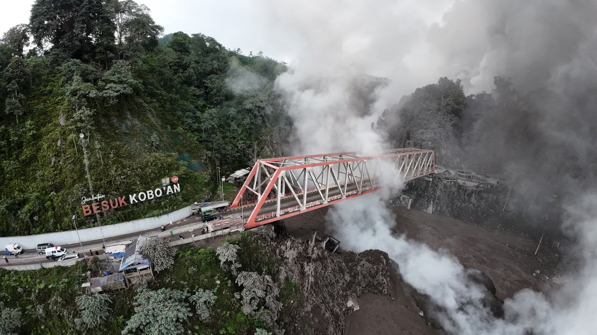
The Geological Agency of the Ministry of Energy and Mineral Resources (ESDM) previously reported that Mount Semeru erupted on Wednesday (19/11) at 16.00 WIB with an eruptive column height of about 2,000 meters above the peak.
In the eruption, Mount Semeru emitted hot clouds which had a sliding distance of up to seven kilometers from the summit with a column of gray ash observed with thick intensity to the north and northwest.
Eruption was recorded on the seismogram of the volcano monitoring post in Lumajang with a maximum amplitude of 40 mm and a duration of about 16 minutes 40 seconds.
SEE ALSO:
-
 | BERITA
Tidak Ada Pemakzulan! Para Kiai Sepakat, Gus Yahya Tetap Pimpin PBNU hingga Muktamar
24 November 2025, 06:06 -
 | OLAHRAGA
Real Betis Resmi Perpanjang Kontrak Isco hingga Tiga Tahun ke Depan
24 November 2025, 00:41 -
 | LIFESTYLE
Wisata Spiritual di Bali, Ini 5 Deretan Tempat Melukat dengan Sumber Air Paling Jernih
24 November 2025, 00:25
The eruption activity of Mount Semeru will certainly end at 18.11 WIB, but the local government and the Geological Agency are still setting Level IV or Alert status to anticipate potential follow-up activities that may occur.
This is also the basis for the stipulation of the Natural Disaster Emergency Response Status which is active until November 26 by the Lumajang Regency Government (Pemkab).
The English, Chinese, Japanese, Arabic, and French versions are automatically generated by the AI. So there may still be inaccuracies in translating, please always see Indonesian as our main language. (system supported by DigitalSiber.id)
Most Popular Tags
#Prabowo Subianto #donald trump #2026 World Cup #venezuela #konflik timur tengahPopular


