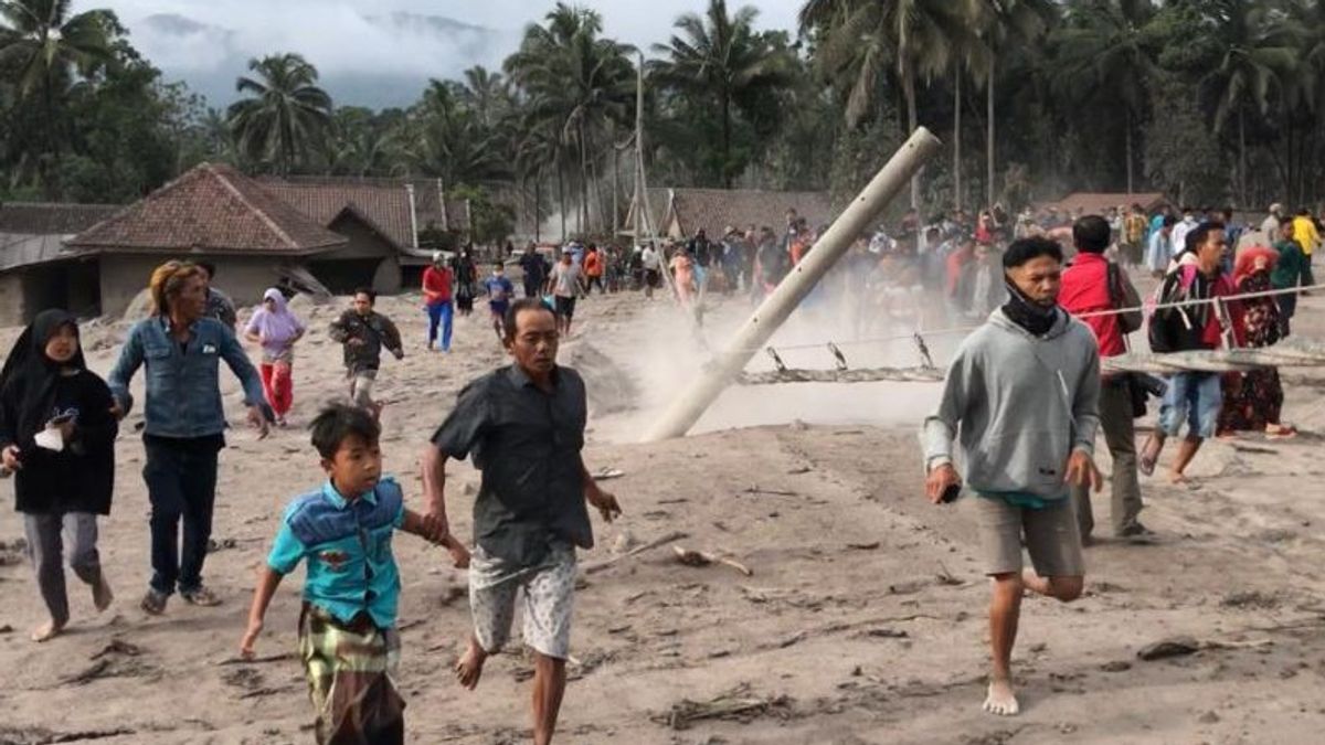


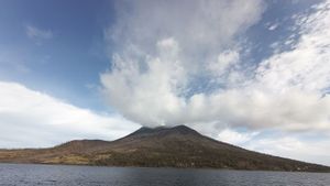
JAKARTA - The Center for Volcanology and Geological Hazard Mitigation (PVMBG) said ejected material the size of ash from Mount Semeru in East Java could spread further depending on wind direction and speed.
PVBMG said the increased volcanic activity of Mount Semeru also presented other potential dangers, namely the ejection of incandescent rock around the peak and hot clouds of avalanches and rock avalanches from the dome/tip of the lava tongue to the southeast and south sectors of the summit.
On December 4, at 14.50 WIB, hot clouds of avalanches were observed with a sliding distance of four kilometers from the peak of Mount Semeru or two kilometers from the tip of the lava flow to the southeast (Besuk Kobokan).
"But until now the distribution and detailed glide distance cannot be ascertained", said the PVMBG statement quoted by Antara, Sunday, December 5.
According to PVMBG, the results of visual observations show that the avalanches and hot clouds of avalanches are caused by the instability of the lava tongue deposits.
According to PVMBG, the volcanic activity of Mount Semeru on December 1 and 4 was surface activity (secondary eruption) and the analysis of seismic data did not show an increase in the number and type of earthquakes associated with the supply of fresh magma/rock to the surface.
On Sunday, according to PVMBG observations, Mount Semeru hurled hot avalanche clouds with a sliding distance of 4,000 meters from the summit or 2,000 meters from the end of the lava flow to the southeast (Besuk Kobokan).
PVMBG also detected volcanic earthquakes related to eruptions, avalanches, and gusts of smoke from the crater, which consisted of 34 eruptions, two hot cloud earthquakes, 13 avalanches, 15 times a gust earthquake, and one distant tectonic earthquake.
SEE ALSO:
-
 | BERITA
Resmikan Monumen Pahlawan COVID-19, Wapres Harap Sistem Kesehatan RI Jadi Lebih Tangguh
04 Desember 2021, 14:45 -
 | BERITA
Terekam Video Tengah Memangsa Rusa, Bukti Perubahan Iklim Juga Dialami Beruang Kutub
04 Desember 2021, 14:32

Based on the results of visual and instrumental monitoring as well as potential hazards, PVMBG stated that the activity level of Mount Semeru is still at Level II (Alert).
In the Level II (Alert) status, residents and tourists are asked not to move within a one-kilometer radius of the crater/peak of Mount Semeru and at a distance of five kilometers from the direction of the crater opening in the south-southeast sector.
Residents are also asked to be aware of the possibility of the emergence of hot clouds avalanches, lava avalanches, and lahars along rivers/valleys that originate at the peak of Mount Semeru, especially along the Besuk Kobokan, Besuk Bang, Besuk Kembar, and Besuk Sarat streams.
The English, Chinese, Japanese, Arabic, and French versions are automatically generated by the AI. So there may still be inaccuracies in translating, please always see Indonesian as our main language. (system supported by DigitalSiber.id)
Most Popular Tags
#Prabowo Subianto #Constitutional Court #israel #iran #Indonesian National teamPopular


Related News