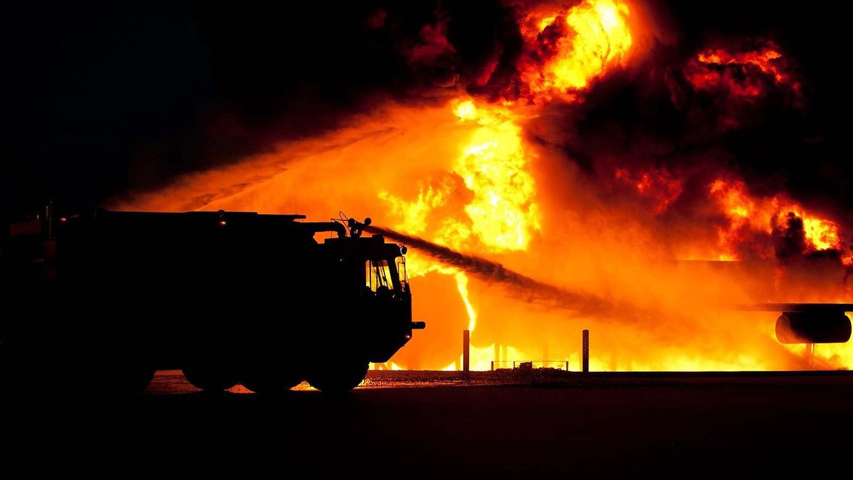


Firefighters in California use artificial intelligence to help detect forest fires. This is done by inserting videos of more than 1,000 strategically placed cameras across the state into machines warning first officers when to mobilize.
For example, a potential ALERTCalifornia AI program launched last month, a camera managed to detect a fire that broke out at 3 am local time in the remote Cleveland National Forest about 80 km east of San Diego.
In conditions when people were sleeping and the darkness was hiding smoke, the fire could have spread to a raging forest fire. But AI warned a firefighter captain who called about 60 firefighters including seven fire trucks, two bulldozers, two water tanks, and two crew members. "Within 45 minutes, the fire was extinguished," Cal Fire said.
Developed by engineers at the University of California San Diego using AI from DigitalPath, a company based in Chico, California, the platform relies on 1,038 cameras installed by various public institutions and power companies across the state, each capable of rotating 360 degrees at the behest of long-range operators.
Since the AI program started on July 10, Cal Fire has set another example in which AI warned fire captain about the fire before 911 calls were made, although they do not yet have a comprehensive report.
Neal aired, a professor of geology and geophysics at UCSD and lead investigator ALERTCalifornia, said that the current sample size was too small to draw conclusions.
Cal Fire hopes that this technology could one day become a model for other countries and states around the world, a necessity stressed by the devastating forest fires in Hawaii, Canada, and the Mediterranean this season.
"This technology is 100% applicable worldwide, especially now that we are experiencing larger and more frequent fires and climate change," said Suzan Leininger, a Cal Fire intelligence specialist in El Cajon, to the east of San Diego.
Part of Leininger's work is to help the learning machine. He reviewed previously recorded videos from a network of cameras about what AI considers a fire, then told the machine whether it was true with binary answers or not. Many phenomena can trigger false positives: clouds, dust, even trucks with exhaust exhausts.
With hundreds of specialists repeating this exercise across the state, AI has become more accurate in just a few weeks,tipsaid.
"Outside of the camera network, the platform collects a lot of additional information, including aerial surveys to measure vegetation that will cause future fires and map the earth's surface under the canopy", said Maritime Affairs.
اقرأ أيضا:
-
 | TEKNOLOGI
Peneliti Temukan Miliaran Prosesor Intel Bocorkan Kata Sandi Pengguna
12 Agustus 2023, 15:25 -
 | TEKNOLOGI
Instagram Uji Coba Fitur Baru yang Mudahkan Pengguna Menandai Banyak Teman di Stories
12 Agustus 2023, 12:05


Airplanes and drones also collect infrared data and other waves that exceed human vision capabilities.
"In winter, this platform is capable of measuring atmospheric rivers and snow sheets. The UCSD team is also collecting data on burn scars and their impact on erosion, sedimentary dispersion, water quality, and soil quality," said cap.
The data, which is available to private companies or academic researchers, can eventually be used to model fire behavior and improve AI applications that have not been seen to study the environment.
"We are facing an extreme climate. So we are providing data to them, because this problem is bigger than all of us," saidLAd. "We need to use technology to help drive change, even if it's just a little.
The English, Chinese, Japanese, Arabic, and French versions are automatically generated by the AI. So there may still be inaccuracies in translating, please always see Indonesian as our main language. (system supported by DigitalSiber.id)
العلامات الأكثر شيوعًا
#Prabowo Subianto #السنة الجديدة #يوم الأم #ناتارو #عيد الميلادجمع