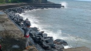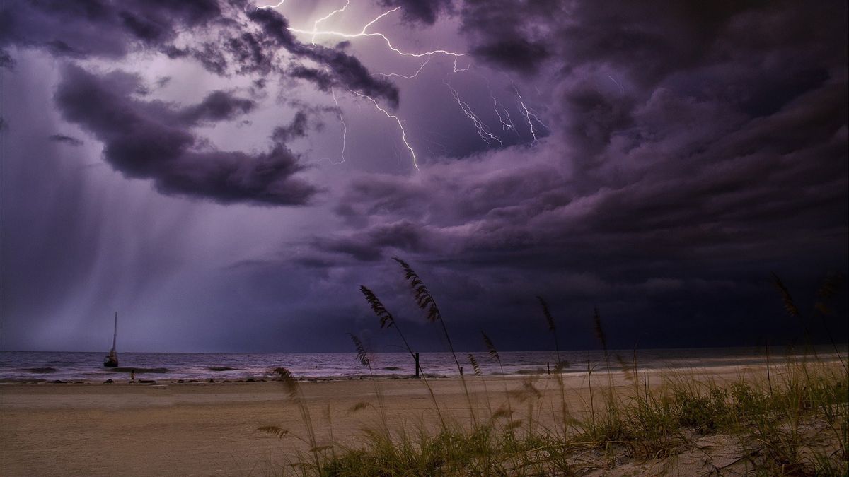


JAKARTA - The Meteorology, Climatology and Geophysics Agency (BMKG) issued an early warning warning of high waves of up to 4 meters which could occur in several Indonesian territorial waters from 30 November to 2 December 2020.
Based on the press release from BMKG, there is a low pressure pattern of 1009 hPa in the western Indian Ocean of Aceh and 1008 hPa in the eastern northern Natuna Sea and the eastern Pacific Ocean of the Philippines.
Reported by Antara, Monday, November 30, BMKG stated that the wind pattern in Indonesia generally moves from southwest to northwest at speeds ranging from 5-25 knots. The highest wind speeds were observed in the waters west of Lampung, the Sunda Strait, the northern waters of Banten and East Java, the southern waters of Central Kalimantan, and the waters north of Biak. This condition causes the wave height around the area.
This condition has resulted in an increase in waves as high as 1.25 to 2.50 meters which are likely to occur in several waters such as the northern waters of Sabang, the western waters of Aceh, the western waters of Simeulue Island to the Mentawai Islands, Enggano waters to Bengkulu, southern Lampung Bay, the western Indian Ocean. Aceh to Bengkulu, the Bali Strait - Lombok to the southern part of Alas and the southern waters of Lombok to Sumbawa.
Then an increase in waves also has the potential to occur in the southern Sape Strait, southern waters of Sumbawa to Savu Island, Savu Sea, western Sumba Strait, southern Kupang waters to Rotte Island, southern Indian Ocean Sumba Island to Rotte Island, Kep. Anambas, waters south of the Natuna Islands, waters of the Subi Islands to Serasan, Natuna Sea, Java Sea,
Then, also in the southern waters of Central Kalimantan, the Makassar Strait, the Flores Sea, the southern waters of Central Kalimantan, the Makassar Strait, the Flores Sea, the Selayar Islands waters to the Sabalana Islands, the Bitung waters to the Sitaro Islands, the Sangihe Islands waters, the Maluku Sea, Tomini Bay, the Sea Sulawesi, the Halmahera Sea, the western and eastern waters of the Halmahera Islands, the northern waters of West Papua to Papua and the northern Pacific Ocean of West Papua to Papua.
In addition, higher waves of around 2.50-4 meters are also likely to occur in several other Indonesian waters, including the northern Natuna Sea, the northern waters of the Natuna Islands, the western waters of Lampung, the western Indian Ocean Lampung, the western and southern Sunda Strait. , the southern waters of Java to Bali, the Indian Ocean south of Java to Lombok, the waters of the Talaud Islands, the northern waters of the Halmahera Islands and the northern Pacific Ocean of Halmahera.
The potential for high waves in some of these areas can pose a risk to shipping safety.
For this reason, BMKG always urges the public to always be vigilant, especially for fishermen who are active with transportation modes such as fishing boats with wind speeds of more than 15 knots and wave heights above 1.25 m, barges with wind speeds of more than 16 knots and high waves in above 1.5 m, ferries with wind speeds of more than 21 knots and wave heights above 2.5 m and large size vessels such as cargo ships or cruise ships with wind speeds of more than 27 knots and wave heights above 4 meters.
Then, BMKG also asked people who live and do activities on the coast around areas that are likely to have high waves to stay alert.
The English, Chinese, Japanese, Arabic, and French versions are automatically generated by the AI. So there may still be inaccuracies in translating, please always see Indonesian as our main language. (system supported by DigitalSiber.id)
العلامات الأكثر شيوعًا
#Prabowo Subianto #السنة الجديدة #pdip #هاستو كريستيانتو #ناتارو #عيد الميلادجمع