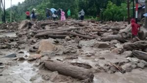


YOGYAKARTA - Geological Engineering Lecturer at the Faculty of Engineering, Gadjah Mada University (UGM) Salahuddin Husein said the Muria Strait would not reappear due to flooding that hit a number of areas in Demak Regency, Central Java and its surroundings.
"Geologically, you don't have to worry that Demak and its surroundings will become a sea again because this repeated flood brings sediment that forms a lowland," said Salahuddin as quoted by ANTARA, Monday, March 25.
From the geological aspect, Salahuddin said that the areas of Demak, Juwana, and Pati, Central Java were originally the Muria Strait which turned into lowlands around the 10th to 15th centuries.
According to him, the formation of the area was due to the existence of sediments that were carried away during repeated flooding.
He stated that the Muria Strait would no longer appear because the geological process in the form of erosion of the Kendeng hills lane and the Rembang hills lane that passes through the network of the Tuntang River, Serang River, and Juwana River is still ongoing today and carries a fairly high sediment.
This condition causes silting in the Muria Strait.
"It's natural that floods occur repeatedly. This is not strange because the lowlands were formed due to flood overflows," he said.
Salahuddin Husein conveyed that the river sedimentation process generally took place during the flood which resulted in sediment deposits collecting into flood runoffs.
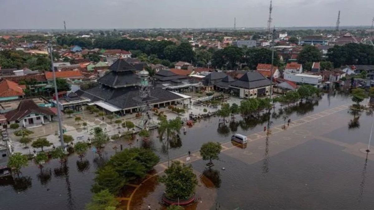
He said the areas of Demak, Pati, and Juwana were lowlands resulting from flood sedimentation from the Tuntang River, Serang River, and Juwana River.
In other words, the Muria Strait disappeared and became the lowland as it is today due to flooding in the three rivers.
He said that there were environmental changes, especially the impact of the rapid growth of settlements in the lowland area of the former Muria Strait, which also had a geological impact.
관련 항목:
-
 | BERITA
Jaksa: KPK Pengakuan Hasbi Hasan Diintimidasi Penyidik Hanya Cari Sensasi
25 Maret 2024, 20:00 -
 | BERITA
Prabowo Usai Menang Pilpres 2024: Amanat akan Saya Laksanakan Sepenuh Hati
25 Maret 2024, 19:01


Geological impacts caused by land compactification for building construction and use of groundwater make the soil compact, congested, and somewhat down.
This, he said, caused the areas of Demak, Pati, and Juwana to be flood-prone, especially in the midst of the increasing hydrometeorological disasters that occur during the current rainy season.
Salahuddin said rain with high intensity and continuous potential to increase water discharge in the upstream area of the river, triggering extreme flooding and will recede for days.
To anticipate similar disasters in Demak and its surroundings, according to Salahuddin, the government needs to review the capacity of river embankments when there is the potential for extreme flooding so that rivers in the area can bring more rainwater discharges without having to cause flooding.
"River normalization efforts have indeed been carried out, but in the future it is necessary to redesign it by adjusting the current conditions," he said.
In addition, Salahuddin sees the need for regular embankment supervision and maintenance efforts so that it can prevent landslide embankments at a number of points that can lead to river silting.
According to him, the silting of the river will reduce the capacity of the embankment.
The English, Chinese, Japanese, Arabic, and French versions are automatically generated by the AI. So there may still be inaccuracies in translating, please always see Indonesian as our main language. (system supported by DigitalSiber.id)