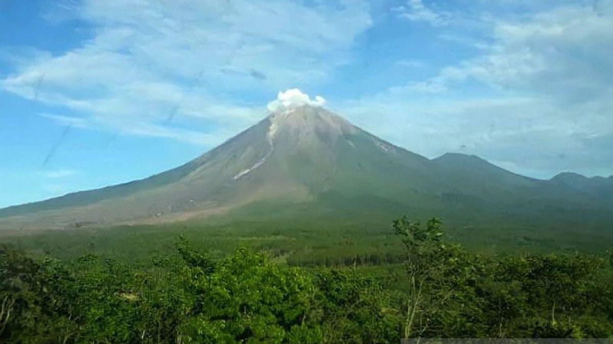
JAKARTA - The Geological Agency of the Ministry of Energy and Mineral Resources (ESDM) has officially lowered the status of Mount Semeru in East Java, from Level IV or Alert to Level III or Alert, Friday, December 9.
"Given the characteristics of the eruption of Mount Semeru, the potential threat of danger, the results of visual monitoring and seismicity, the level of activity of Mount Semeru can be lowered from Level IV (Awas) to Level III (Alert) starting December 9, 2022 at 12.00 WIB," said Acting Head of the Geological Agency Muhammad Wafid in a statement quoted in Jakarta, Antara, Friday, December 9.
Wafid said the level of activity of Mount Semeru would be reviewed if there were the emergence of volcanic earthquakes and deformations related to the process of supplying magma to the surface, such as low-frequency earthquakes, tremors, tiltmeters, and GPS in a significant trend.
He said that the results of visual observations showed that currently there was still eruption activity which then caused a pile of eruptive material or pyrochlastic cone or lava tongue.
When the weather was clear, weakly stressed white crater smoke was observed with a thin to moderate intensity with a height of 500 meters above the peak.
The Geological Agency noted that there were two hot clouds of avalanche with a sliding distance of up to 6 kilometers to the southeast with an avalanche distance of 300 meters to 500 meters. Volcanic earthquakes are still recorded and fluctuate, including earthquake eruptions and avalanches.
After the hot cloud avalanche incident on December 4, 2022, the Geological Agency noted that four hot clouds had fallen with a decreasing duration and distance.
Observations since December 4, 2022 until now show that there are no symptoms of a significant increase in activity towards hot clouds of avalanches that are quite large. The accumulation of eruptions into hot clouds of avalanches that exceed 7 kilometers takes time.
Thermal image indicates an anomaly that decreased for the period from December 4 to December 9, 2022, from 15 MW to 27 MW which indicates that there was a buildup of incandescent material around the crater surface. On December 2, 2022, the sulfur dioxide anomaly from the image of Aura/OMI actually looks at 1.78 unit dobsons and is currently only observed at 0.62 unit dobsons.
Inflational postgraduation accompanied by eruptions on December 4, 2022, the deformation of Mount Semeru has so far shown a decline from the tiltmeter instrument.
"The potential threat of the danger of Mount Semeru is currently in the form of lava floods if the material produced by the eruption and hot clouds of avalanches are mixed with high rain intensity, especially in rivers that originate at the peak, namely Besuk Bang, Besuk Kembar, Besuk Kobokan, and Besuk Sat, as well as the tributaries around it," said Wafid.
Mount Semeru, which has a height of 3,676 meters above sea level, is administratively located in two districts, namely Lumajang Regency and Malang Regency in East Java Province.
The volcano was monitored visually and instrumentally from two Volcano Observation Posts (PGA) located in Sumber Wuluh Village, Candipuro District, Lumajang Regency, and in Agrosuko Village, Ampelgading District, Malang Regency.
On December 4, 2022, the government raised the status from Level III or Alert to Level IV or Watch out for the high volcanic activity and eruptions that occurred on Mount Semeru. After five days later and volcanic activity was observed to decline, the government then decided to reduce the status of the volcano to Level III or Alert.
The English, Chinese, Japanese, Arabic, and French versions are automatically generated by the AI. So there may still be inaccuracies in translating, please always see Indonesian as our main language. (system supported by DigitalSiber.id)
Tags les plus populaires
#Prabowo Subianto #Golkar #OTT KPK #élections jakarta #jeux d’argent en lignePopulaire
25 November 2024, 01:03


