

BOGOR - The Bogor Regency Government (Pemkab) has requested a recommendation from the Geological Agency for the land shift disaster that occurred in Bojongkoneng Village, Babakanmadang District.
"We ask for a study by the Geological Agency, can it still be lived in or what? The study will be our basis for handling its long term," said Acting Regent of Bogor, Iwan Setiawan in Cibinong, Bogor Regency, West Java, quoted from Antara, Friday, September 16.
As a first step, he has set an emergency response status for land shifts in the area through the Regent's Decree (Kepbup) Number 360/19/Kep-TD/BPBD.
Iwan said the Kepbup could form the basis for all regional apparatus within the Bogor Regency Government in handling the impact caused by the land shift due to the impact.
The mention of a disaster that causes damage to a number of infrastructures needs to be handled optimally, because it threatens safety and is materially detrimental to the community.
"We need to determine the Bogor Regent's Decree regarding the determination of the emergency response status for land shifts in Bojongkeneng Village. This will be our legal umbrella to handle this," said Iwan.
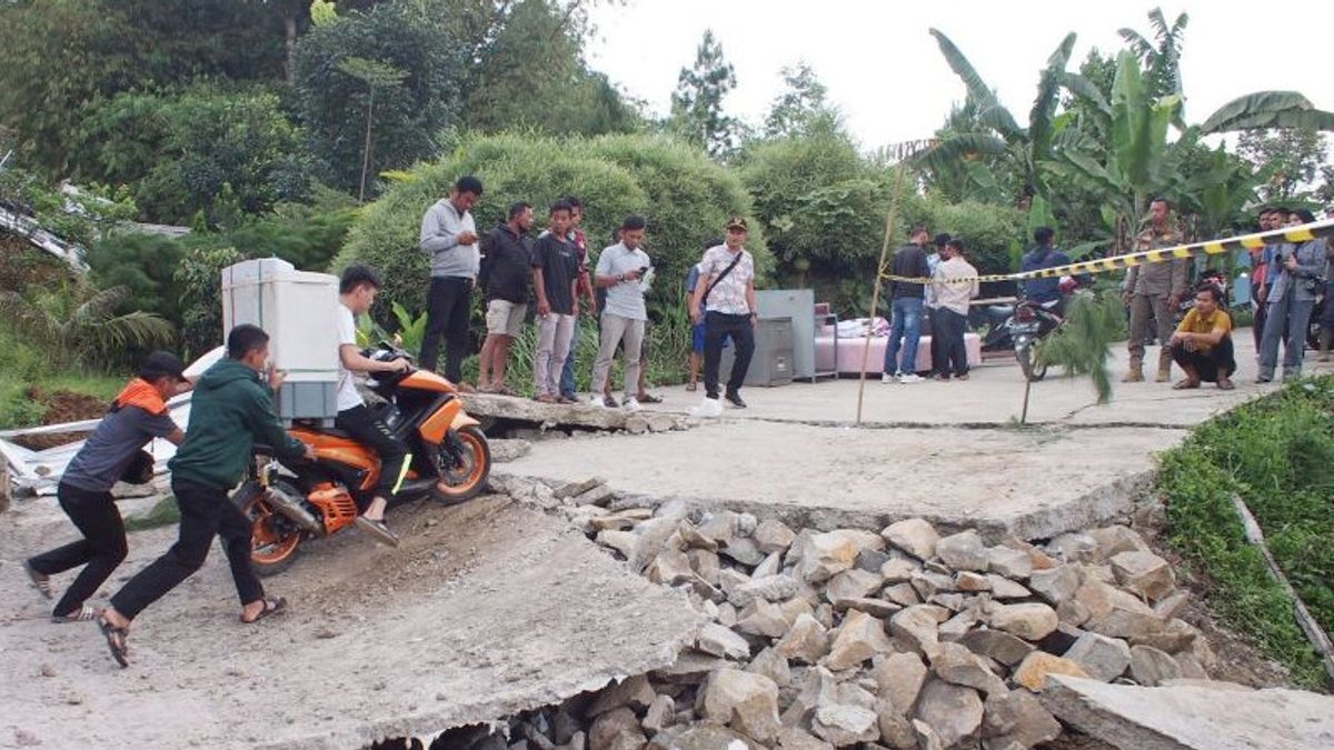
Head of the Bogor Regency BPBD Emergency and Logistics Division, Aris Nurjatmiko, said that the shift in land that had occurred since Wednesday, September 14, caused damage to at least 23 buildings and part of the road along one kilometer.
BPBD noted that 24 residents were displaced due to the shift in land in Bojongkoneng Village.
"From this incident, 20 families were affected, then 177 families were threatened from two RWs with a total (residents) of 589 people," said Aris.
Previously, the Geospatial Information Agency (BIG) stated that there were 10 sub-districts in Bogor Regency that had a high risk of experiencing disasters due to land movement, namely Sukajaya, Nanggung, Leuwiliang, Citeureup, Babakan Madang, Sukamakmur, Tamansari, Tenjolaya, Cijeruk, and Cigombong.
"There are several aspects that are considered in determining areas prone to ground movement, including the topography of the region. The assumption is that the steeper it is, the more vulnerable the ground movement will be," said Head of Disaster Mapping and Climate Change Division of BIG Ferrari Pinem.
The English, Chinese, Japanese, Arabic, and French versions are automatically generated by the AI. So there may still be inaccuracies in translating, please always see Indonesian as our main language. (system supported by DigitalSiber.id)