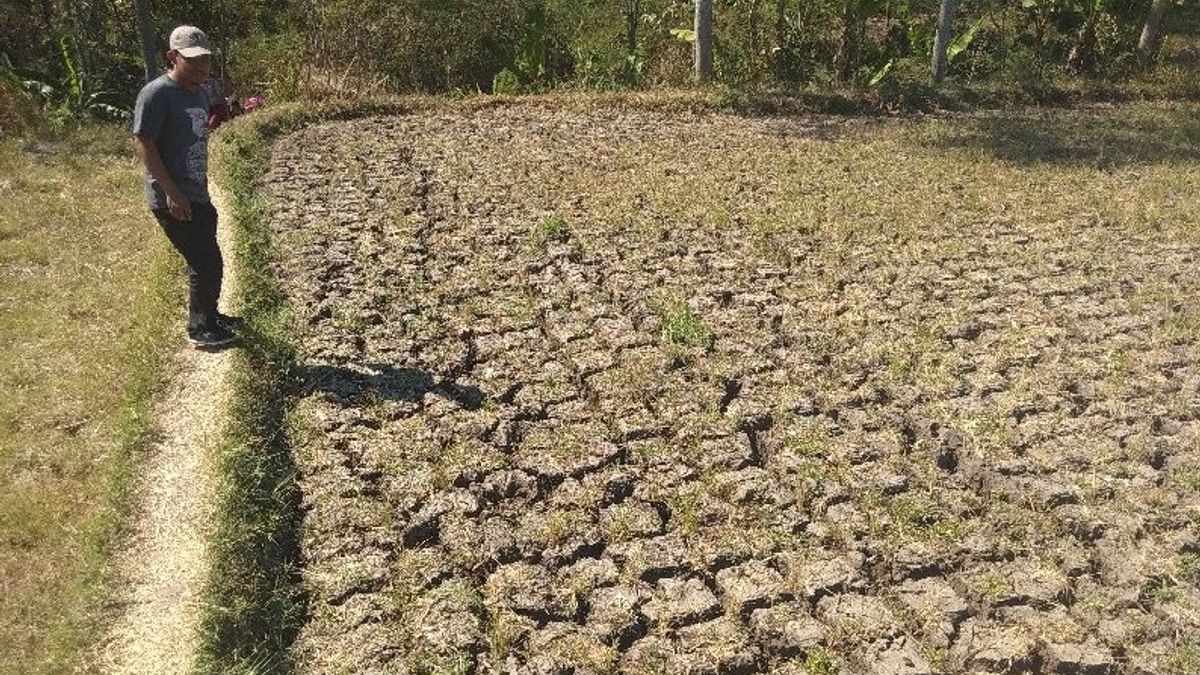
CILACAP - The southern part of Central Java and the central mountains of Central Java have entered a transition period or transition from the rainy season to the dry season according to the Meteorology, Climatology and Geophysics Agency (BMKG).
"Now we have entered a transitional period, marked by warmer air temperatures in the morning and afternoon," said Teguh Wardoyo, Head of the BMKG Technician Group at the Cilacap Meteorological Station, Teguh Wardoyo, in Cilacap, Thursday, April 7.
As an illustration, he said, the maximum air temperature at the Tunggul Wulung Meteorological Station in the last few days had ranged from 32 to 33 degrees Celsius, an increase from the air temperature in the previous month which was in the range of 31 to 32 degrees Celsius.
The arrival of the transition period, according to him, is also marked by winds that change direction and heavy rain that suddenly falls accompanied by lightning and strong winds.
"The rain is uneven and tends to occur frequently in the afternoon and evening," he said, quoted by Antara.
"Therefore, the public still needs to be aware of the possibility of hydrometeorological disasters, especially in the mountainous areas of Central Java, because rainfall in April 2022 is predicted to remain high," he added.
VOIR éGALEMENT:
According to him, rainfall in the central highlands of Central Java in April 2022 is predicted to range from 300 to 500 millimeters and in the Cilacap region generally 200 to 300 millimeters, except in Majenang and its surroundings (west-north part of Cilacap) where rainfall is estimated to range from 300 to 400. millimeter.
Teguh said that the southern waters of West Java to the Special Region of Yogyakarta as well as the southern Indian Ocean of West Java-Yogyakarta Special Region are now also entering a transition period from the westerly monsoon season to the easterly wind season.
"Later on, when it has really entered the transition period, the waves in the waters and the Indian Ocean will be gentle. If it is still fluctuating, sometimes high waves occur, because there is still low pressure in the Indian Ocean south-southwest of Java Island," he said.
He gave an example on April 7 at 19.00 p.m. to April 8 at 19.00 p.m., the wave height in the southern waters of Sukabumi-Cianjur, southern waters of Garut-Pangandaran, southern Indian Ocean of West Java, southern waters of Cilacap, southern waters of Kebumen-Purworejo, southern waters of Yogyakarta, and the southern Indian Ocean, Central Java-Yogyakarta, is estimated at 1.25 meters to 2.5 meters or is in the medium category.
From April 8 at 19.00 p.m. to April 9 at 19.00 p.m., wave heights in the southern Indian Ocean region of West Java and the southern Indian Ocean of Central Java-Yogyakarta Special Region are estimated to range from 2.5 meters to four meters or fall into the category of wave height and height in the waters south of Sukabumi to Yogyakarta is estimated at 1.25 meters to 2.5 meters.
The English, Chinese, Japanese, Arabic, and French versions are automatically generated by the AI. So there may still be inaccuracies in translating, please always see Indonesian as our main language. (system supported by DigitalSiber.id)


