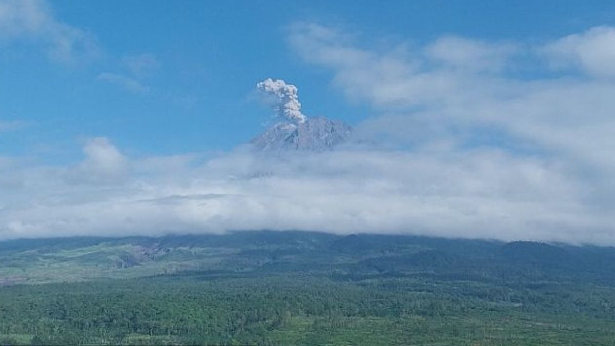


JAKARTA - Mount Semeru, which is on the border of Lumajang and Malang Regencies, East Java, erupted with an eruption height of 900 meters above the peak on Sunday morning.
"Mount Semeru erupted at 08.00 WIB with an observed eruption column height of about 900 meters above the peak or 4,576 meters above sea level (msl)," said Mount Semeru Observation Post Officer Sigit Rian Alfian as reported by ANTARA, Sunday, May 3.
According to him, the column of volcanic ash of Semeru was observed to be white to gray with thick intensity towards the southwest.
"The eruption was recorded on the seismograph with a maximum amplitude of 22 mm and a duration of 111 seconds," he said.
Mount Semeru's activity on Sunday for the last six hours at 00.00 - 06.00 WIB was 18 times the eruption/erupting earthquake with an amplitude of 10-22 mm, and the earthquake lasted 89-201 seconds.
Semeru also experienced one eruption earthquake with an amplitude of 4 mm, and a long earthquake of 60 seconds, one harmonic with an amplitude of 10 mm, and a long earthquake of 148 seconds.
One tectonic far-field earthquake with an amplitude of 6 mm, S-P 53 seconds and a long earthquake of 140 seconds.
He explained, Mount Semeru has a Level III (Alert) status with recommendations, the public should not carry out any activities in the southeast sector along Besuk Kobokan, as far as 13 kilometers from the peak (center of the eruption).
"Outside this distance, the public is advised not to carry out activities within 500 meters from the river bank (river border) along Besuk Kobokan because they have the potential to be hit by the expansion of the hot cloud and lava flow up to 17 kilometers from the peak," he said.
The public is also prohibited from carrying out activities within a radius of five kilometers from the crater or peak of Mount Semeru because they are prone to the danger of stone throwing (pijar).
He also appealed to residents to be aware of the potential for hot clouds, lava discharge, and lava along the river/valley streams upstream of the summit of Mount Semeru.
"Especially along Besuk Kobokan, Besuk Bang, Besuk Kembar, and Besuk Sat and the potential for lava on small rivers which are tributaries of Besuk Kobokan," he said.
The English, Chinese, Japanese, Arabic, and French versions are automatically generated by the AI. So there may still be inaccuracies in translating, please always see Indonesian as our main language. (system supported by DigitalSiber.id)
Most Popular Tags
#Prabowo Subianto #donald trump #2026 World Cup #Febrie Adriansyah #8791Popular


