

KENDARI - The Meteorology, Climatology and Geophysics Agency (BMKG) said that the active fault activity caused a tectonic earthquake in East Kolaka Regency (Koltim), Southeast Sulawesi (Sultra), on Monday morning.
Acting Head of the Regional Center for Meteorology, Climatology and Geophysics (BMKG) for Region IV Makassar, Nasrol Adil, when contacted in Kendari, Monday, explained that the magnitude 2.9 earthquake occurred at 03.23.15 Wita.
"By taking into account the epicenter location and the hypocenter depth, the earthquake that occurred is a shallow earthquake type due to active fault activity," he said.
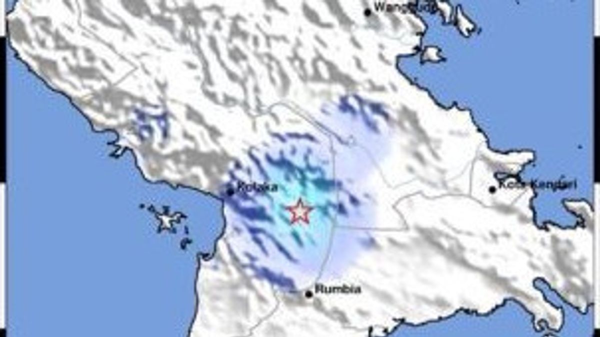
He said that based on the results of the BMKG analysis, the epicenter of the earthquake was located at coordinates 4.10 LS and 121.87 BT, or precisely on land at a distance of 11 km south of East Kolaka with a depth of 5 km.
Nasrol Adil said based on community reports and the estimated shakemap, the earthquake was felt in the East Kolaka area with an intensity scale of III MMI.
"The vibration was felt real in the house. It felt like there was a truck passing by," he said.
He revealed that until now, BMKG has not reported any damage caused by the earthquake.
In addition, the results of monitoring until 03.43 Wita did not show any signs of aftershocks.
he also appealed to the public to remain calm and ensure that the information received comes from official BMKG sources through verified communication channels, such as the official website, the BMKG Info Mobile Apps application, or social media @infoBMKG.
"Make sure that official information only comes from BMKG which is disseminated through verified official communication channels," said Nasrol Adil.
The English, Chinese, Japanese, Arabic, and French versions are automatically generated by the AI. So there may still be inaccuracies in translating, please always see Indonesian as our main language. (system supported by DigitalSiber.id)


