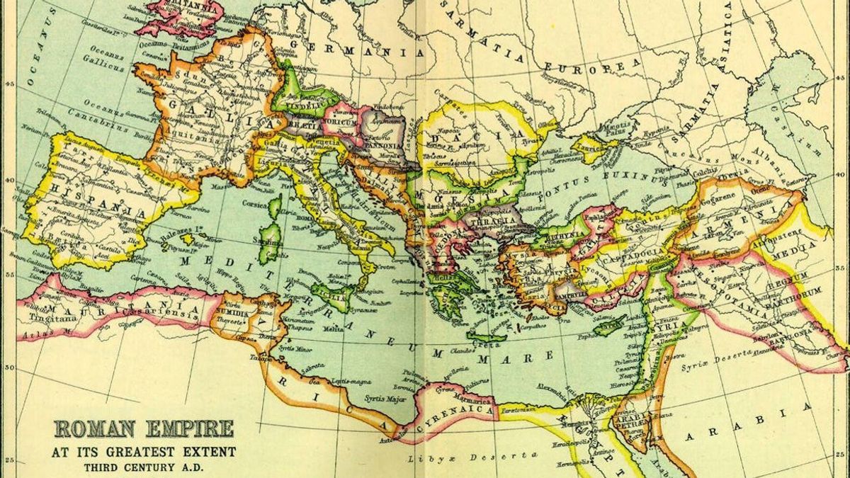


JAKARTA - A digital map published earlier this month unveiled the unknown Roman streets and stretched 50 percent of the previously known road networks.
The last major Atlas ancient Roman road network was published 25 years ago. Since then, advances in technology and new accessible sources have greatly expanded the researchers' ability to find ancient streets.
For five years, a team of archaeologists combed historical records, ancient journals, historical milestones, and other archival data. Scientists then searched for clues in satellite images and aerial photos, including the latest digital photos taken from aircraft during World War II.
When ancient records hinted at missing roads in an area, the researchers analyzed the terrain from above to find fine traces - things like faint differences in vegetation, soil variations or altitude shifts, as well as traces of ancient techniques such as raising mounds or slopes of prescribed hills - which reveal where Roman paths once existed.
"This is a big game connecting points on a continental scale," said Tom Brughmans, an archaeologist and co-author of the study published in Scientific Data.
Interactive digital data and maps are also available online for academics, history teachers, or anyone interested in ancient Roman history.
Previous research focused on "the Roman Empire highway" - the most frequently mentioned major highway in common historical records, Brughmans said.
This updated map complements more detail about "secondary roads, such as rural roads, connecting villas and agriculture" and other locations, said Brughmans, based at Aarhus University in Denmark.
The researchers previously calculated the length of the Roman road to be about 117,163 miles (188,555 kilometers). Meanwhile, research The new research shows nearly 186,000 miles (300,000 kilometers) of roads that cross the Roman Empire region, which allows travel from Spain to Syria.
The study greatly enriched archaeologists' knowledge of ancient streets in North Africa, the French plains, and on the Peloponnesos peninsula in Greece.
"This will be a very basic work for many other studies," said archaeologist Benjamin Ducke of the German Institute of Archeology in Berlin, who was not involved in the project.
However, one thing that needs to be considered, he said, is that it is still unclear whether all these roads have been opened and active at the same time.
Being able to visualize ancient routes traversed by farmers, soldiers, diplomats, and other Roman travelers will provide a better understanding of the main historical trends that depend on human movement during Roman times, said Brughmans, including the rise of Christianity throughout the region and the spread of ancient outbreaks.
SEE ALSO:
-
 | BERITA
Menlu RI Tekankan Pentingnya Pemulihan Kebutuhan dan Martabat Rakyat Palestina di PDG 2025
22 November 2025, 09:16 -
 | BERITA
Rusia Gagalkan Peledakan Rel Kereta di Krasnodar, Tuduh Badan Intelijen Ukraina
22 November 2025, 05:00 -
 | BERITA
Kelompok Bersenjata Culik 52 Siswa, Guru dan Staf Sekolah Katolik di Nigeria
22 November 2025, 04:00


"The Romans are leaving a huge impact on this road network," which creates blueprints for many of the roads still in use to date, said study co-author Adam Pazout of the Autonomous University of Barcelona.
Roman engineering achievements to build and maintain roads - including curved stone bridges and tunnels through hill slopes - still form the geography and economy of the Mediterranean region and its surroundings, he said.
The English, Chinese, Japanese, Arabic, and French versions are automatically generated by the AI. So there may still be inaccuracies in translating, please always see Indonesian as our main language. (system supported by DigitalSiber.id)
Most Popular Tags
#Prabowo Subianto #donald trump #2026 World Cup #Febrie Adriansyah #8791Popular


