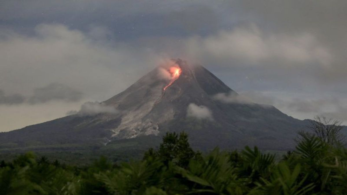


YOGYAKARTA - Mount Merapi, which is located on the border of the Special Region of Yogyakarta and Central Java, has again shown an increase in volcanic activity. Based on a report from the Geological Disaster Technology Research and Development Center (BPPTKG), during the observation period on April 2, 2025 at 00.00 to 06.00 WIB, Mount Merapi was recorded 12 times vomiting out incandescent lava.
"The 12 lava avalanches of Mount Merapi have been observed to the southwest, namely to Kali Krasak and Bebeng, with a maximum sliding distance of 1,700 meters," said Head of BPPTKG Agus Budi Santoso in his official statement, Wednesday, April 2.
Gempatan reports show an increase in volcanic activity, including 41 avalanches with an amplitude of 2 mm to 6 mm (38.31 seconds to 169.27 seconds), 48 times a hybrid earthquake or multi-phase with an amplitude of 2 mm to 8 mm (8.94 seconds to 13.82 seconds), and two distant tectonic earthquakes with an amplitude of 2 mm to 6 mm (32.68 seconds to 93.28 seconds).
Currently, the status of Mount Merapi is still at level III or alert. BPPTKG urges the public not to move within the danger zone, which includes the south-southwest sector (Bong River with a maximum radius of 5 km, as well as the Bedog, Krasak, and Bebeng rivers as far as 7 km), and the southeast sector (Woro River with a maximum of 3 km and Gendol River with a maximum of 5 km).
SEE ALSO:
-
 | OLAHRAGA
Dramatis! Real Madrid ke Final Copa del Rey Usai Tahan Real Sociedad 4-4
02 April 2025, 07:07


In addition to lava avalanches, the public is also asked to be aware of the potential for hot clouds of avalanches (APG) and lahars, especially when it rains around Mount Merapi.
The impact of volcanic ash also needs to be anticipated. If there is a significant change in volcanic activity, BPPTKG will immediately re-evaluate Merapi's status.
The English, Chinese, Japanese, Arabic, and French versions are automatically generated by the AI. So there may still be inaccuracies in translating, please always see Indonesian as our main language. (system supported by DigitalSiber.id)
Most Popular Tags
#Prabowo Subianto #donald trump #2026 World Cup #Febrie Adriansyah #8791Popular


