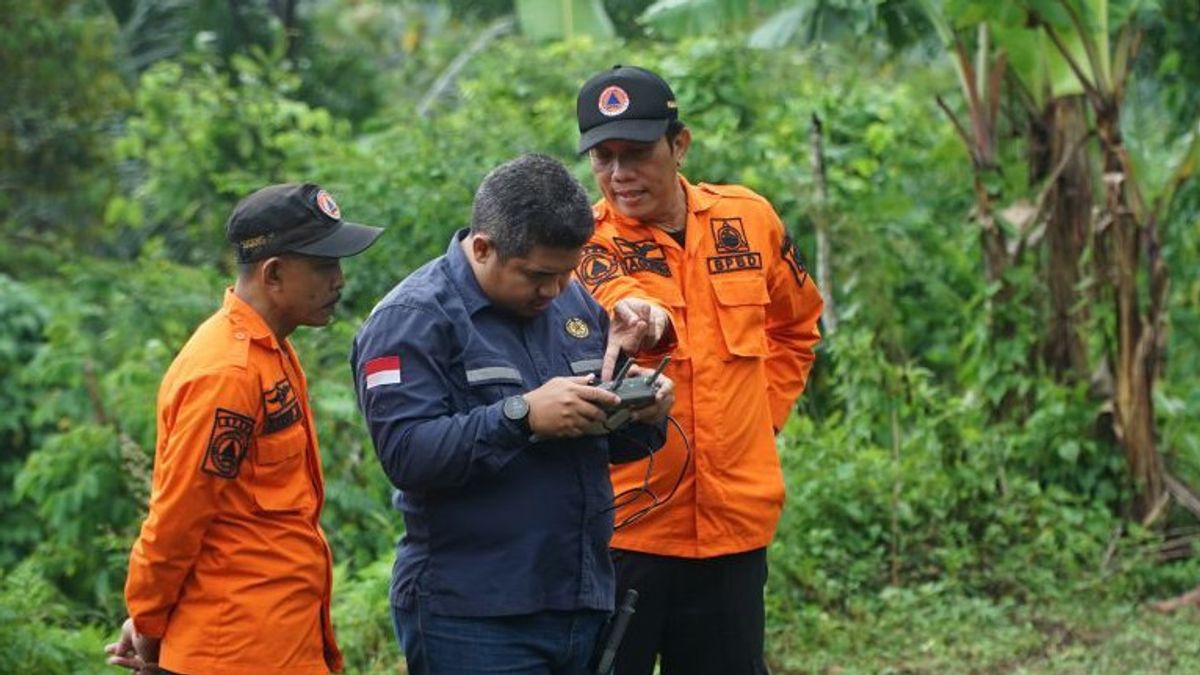


The Center for Volcanology and Disaster Mitigation (PVMBG) of the Ministry of Energy and Mineral Resources' geological body found two main fractures that were interconnected and identified as landslide crowns at the location of the land disaster in Ngrandu Village, Suruh District, Trenggalek Regency, East Java.
"Initially we thought there were two landslide crowns when doing geological mapping in the field. However, after air observations were made using a drone, it turned out that these two fractures were connected, so it was concluded that this was still a crown but with a wide coverage," said the Head of the PVMBG Working Team of the Geological Agency, Oktory Prambada, as reported by ANTARA, Wednesday, January 15.
Air photos also show the spread of soil cracks occurring intensively downstream. The soil crack points northeast and southwest.
"We are still identifying in the landslide crown whether this crack will potentially pull the top again," he said.
This landslide point is circular from the west, north to east with small cracks with a straight direction (90 degrees) from the fault direction.
This condition makes the potential for multiple disasters, namely floods and landslides at once. The risk of flooding is because small river networks have been formed from upstream to downstream.
Meanwhile, the potential for landslides to increase due to the entry of water into soil cracks will make the soil layer and weather rock in the affected area soft and easily slide.
The potential for further landslides to increase because until now the affected areas have not been handled.
The soil fragments in the village area were left gaping without any closing efforts, so that water easily entered the ground and formed landslides.
"The crack as we can see has not been handled properly. Then this area also enters a weak area, because in the southwest there is an elongated fault. There are intensive cracks and it consistently leads to faults according to the geological map," he said.
Not only that, in the landslide area, there is a river flow that participates in bringing soil material downstream. "So the potential for further landslides is still large, it can even be prone to flooding," said Okto.
Geologically, he continued, the land for movement and landslides in Ngrangdu Village, Suruh District was triggered by multifactors.
In addition to the high rainfall intensity factor, the condition of the made-up rock which is dominated by old volcanic rocks and land use procedures that do not consider natural balance also triggers landslides in this area.
"Rainfallfall has played quite a role, especially in the last two months it has been very high. The impact of the rocks here is that volcanic rock is less mixed and then the area is weak because it is close to faults," he said.
SEE ALSO:
-
 | BERITA
Menteri Kenya Sebut Anaknya Diculik Intelijen Nasional Saat Protes Antipemerintah
15 Januari 2025, 21:45 -
 | BERITA
Hamas Dilaporkan Setujui Gencatan Senjata Gaza termasuk Pembebasan Sandera Israel
15 Januari 2025, 20:29


This research team from PVMBG works from Monday (13/1) to Friday (17/1). The main task and function of the work team from the Geological Agency of the Ministry of Energy and Mineral Resources is to do geological mapping, then there is mapping of cover rocks, rocks from the surface, then identification of geology to find out if there are faults or faults.
Furthermore, they will issue recommendations in the form of a situation map featuring a crown of landslides, cracks, avalanche directions and potential landslides going forward.
The results of the research will be submitted to the Trenggalek Regional Disaster Management Agency (BPBD) to be followed up as the basis for determining policies.
"It will be known whether this area can still be handled independently or must be relocated. We are also asked to examine the location which is planned to be used as a relocation site," said Okto.
The English, Chinese, Japanese, Arabic, and French versions are automatically generated by the AI. So there may still be inaccuracies in translating, please always see Indonesian as our main language. (system supported by DigitalSiber.id)
Popular


