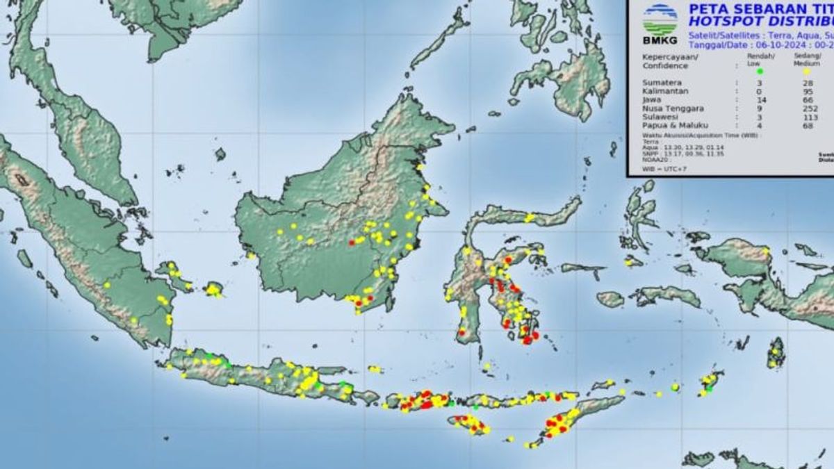


JAKARTA - The Meteorology, Climatology and Geophysics Agency (BMKG) of El Tari Kupang Station reported that there are 24 hotspots in the East Nusa Tenggara (NTT) region that have the potential to cause forest and land fires (karhutla).
"Currently 24 hotspots are being monitored, so we have to watch out for them," said BMKG forecaster for Class II Meteorological Station El Tari Kupang Vitro Nurvandyanto in Kupang, Monday, October 7, which was confiscated by Antara.
Hotspots that have the potential to cause land fires are found in six districts, namely Kupang Regency, South Central Timor, West Sumba, East Sumba, Alor and Lembata Regency.
The most hot spots are in Kupang Regency, namely nine hotspots, spread over five sub-districts, namely Southwest Amfoang, South Amfoang and West Fatuleu and West Amfoang Districts.
SEE ALSO:
-
 | BERITA
Ketua DPRD soal OTT KPK di Kalsel: Jadi Pembelajaran OPD di Provinsi
07 Oktober 2024, 13:10 -
 | BERITA
Timses Sebut Pramono-Rano Tak Masalah Tuntaskan Program Gubernur Terdahulu
04 Oktober 2024, 13:40


He added reports of this hot spot based on NOAA satellite imaging through Terra and Aqua modes.
In this connection, BMKG urges the public to be vigilant because there is a potential for fires to occur.
He explained that hotspots could be used to identify the initial events of forest and land fires.
"For this satellite data, it does not use percent, for green it shows a low level of trust, yellow is a moderate level of trust, and red shows a high level of trust," said Nurvandyanto.
The higher the level of trust, he said, the higher the potential that the hotspot is really land or forest fires that occur.
The English, Chinese, Japanese, Arabic, and French versions are automatically generated by the AI. So there may still be inaccuracies in translating, please always see Indonesian as our main language. (system supported by DigitalSiber.id)


