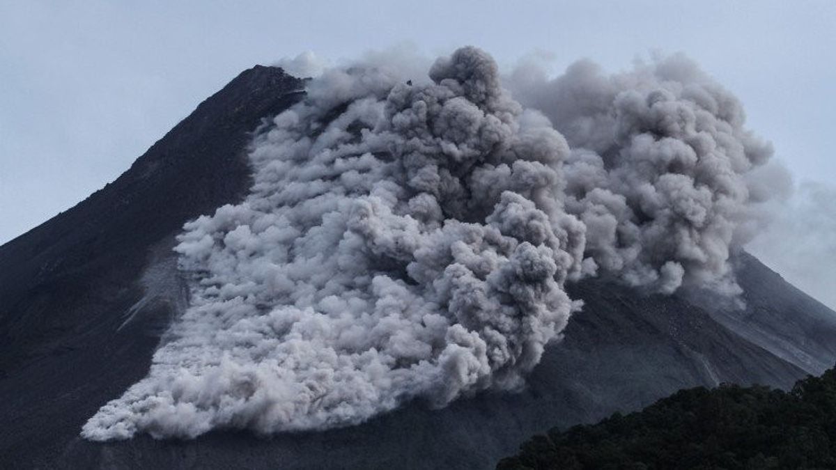


SLEMAN - Volcanic activity of Mount Merapi shows a fairly high intensity in the last few days. On Wednesday, October 2 morning, Mount Merapi was observed removing 30 lava avalanches to the southwest (Kali Bebeng) as far as 1,600 meters.
The Geological Disaster Technology Research and Development Center (BPPTKG) in observations Wednesday from 00.00 WIB to 06.00 WIB stated that the visual of the mountain was clear. Weak pressure crater smoke was observed to be white with thick intensity and a height of 125 m above the crater peak.
BPPTKG said the current potential danger is in the form of lava avalanches and hot clouds in the south-southwest sector covering the Boyong River as far as a maximum of 5 km. Then, the Bedog, Krasak, and Bebeng rivers are a maximum of 7 km. In the southeast sector covering the Woro River as far as a maximum of 3 km and the Gendol River as far as 5 km.
"The eruption of volcanic material in the event of an explosive eruption can reach a radius of 3 km from the summit. Monitoring data shows that magma supply is still ongoing which can trigger hot clouds falling inside potential hazard areas," he continued.
For this reason, the public is advised not to carry out any activities in areas of potential danger and be aware of the dangers of lava and hot clouds avalanches (APG), especially when it rains around Mount Merapi.
SEE ALSO:
-
 | TEKNOLOGI
Shiba Inu Segera Luncurkan Shib the Metaverse, Ini Bocoran Informasinya!
02 Oktober 2024, 01:05


The public is also asked to anticipate disturbances caused by volcanic ash from the eruption of Mount Merapi. If there is a significant change in activity, the level of activity of Mount Merapi will soon be reviewed.
"30 lava avalanches were observed to the southwest (Kali Bebeng) with a maximum sliding distance of 1600 meters," said BPPTKG in its official statement.
The English, Chinese, Japanese, Arabic, and French versions are automatically generated by the AI. So there may still be inaccuracies in translating, please always see Indonesian as our main language. (system supported by DigitalSiber.id)
Most Popular Tags
#Prabowo Subianto #donald trump #2026 World Cup #Febrie Adriansyah #8791Popular


