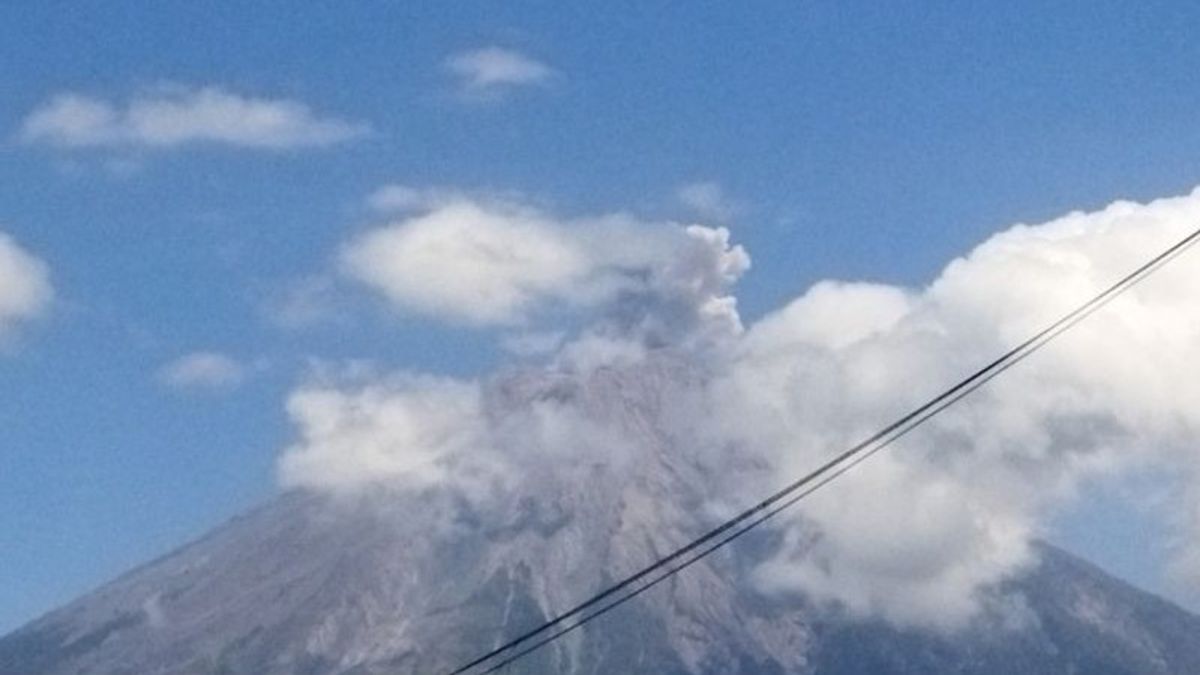


The eruption that occurred on Mount Semeru occurred several times in the early hours of Sunday, September 29. The mountain abundance, which is located on the border of Lumajang and Malang regencies, East Java, reaches 500 meters and above the peak.
Based on the officer's records, Mount Semeru was recorded several eruptions, namely at 00.11 WIB, at 00.20 WIB, at 00.24 WIB, at 00.32 WIB, at 00.57 WIB with visual eruptions not being observed and when the report was made, the eruption was still ongoing.
"The Semeru Monument erupted again at 05.04 WIB with an eruption height of approximately 500 meters above the peak or 4,176 meters above sea level (masl)," said Mount Semeru Observation Post Officer, Liswanto in a written statement received in Lumajang.
According to him, the eruption also caused the ash column to be observed to be white to gray with moderate intensity to the south. When the report was made, the eruption was still ongoing.
Not long after, the highest mountain on the island of Java erupted at 05.18 WIB with an eruption height of about 400 meters above the peak. The ash column was observed to be white to gray with moderate intensity to the south.
"There was an eruption of Mount Semeru again at 05.46 WIB with an eruption height of about 500 meters above the peak or 4,176 mdpl. The ash column was observed to be white to gray with moderate intensity to the south," he said as quoted by ANTARA.
SEE ALSO:
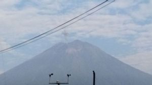
Then the mountain, which has an altitude of 3,676 meters above sea level, erupted again at 08.42 WIB with visually an eruption not being observed and the eruption was recorded on a seismograph with a maximum amplitude of 22 mm and a duration of 110 seconds.
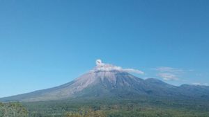
Mount Semeru is still on Alert status, so the Center for Volcanology and Geological Hazard Mitigation (PVMBG) provides a number of recommendations, namely that people are prohibited from carrying out any activities in the southeast sector along Besuk Kobokan as far as eight kilometers from the summit (the center of the eruption).
Then outside of that distance, he said, people are not allowed to carry out activities at a distance of 500 meters from the riverbank (river border) along Besuk Kobokan, because it has the potential to be affected by the expansion of hot clouds and lava flows up to a distance of 13 km from the summit.
The community is also not allowed to move within a 3 km radius of the crater/peak of Mount Semeru, because it is prone to the danger of throwing stones (lightning).
In addition, he said, it is necessary to be aware of the potential for hot clouds, lava avalanches, and lahars along rivers/valleys that originate at the top of Mount Semeru, especially along Besuk Kobokan, Besuk Bang, Besuk Kembar, and Besuk Sat, as well as the potential for lava in small rivers that are tributaries of Besuk Kobokan.
The English, Chinese, Japanese, Arabic, and French versions are automatically generated by the AI. So there may still be inaccuracies in translating, please always see Indonesian as our main language. (system supported by DigitalSiber.id)


