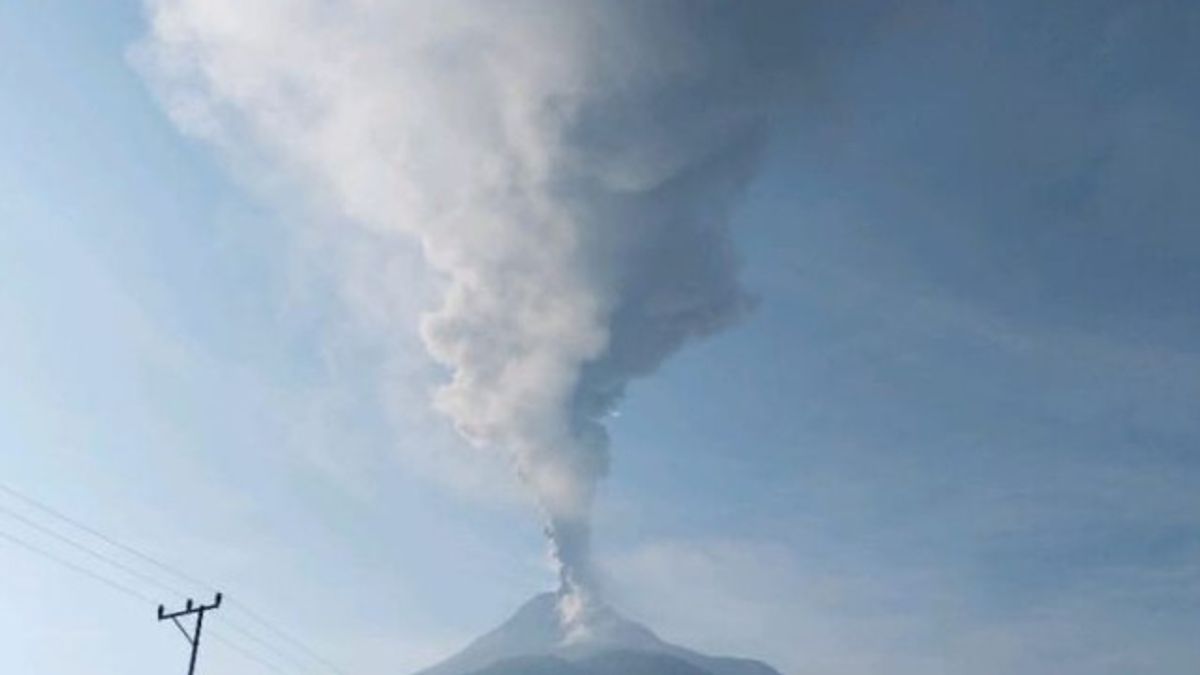


MAUMERE - The Geological Agency of the Ministry of Energy and Mineral Resources (ESDM) reminded residents around Mount Lewotobi Laki in East Flores, East Nusa Tenggara (NTT) to be aware of the eruption / eruption of the mountain that occurs with a height of up to 1,500 meters from the top of the mountain.
"People around Mount Lewotobi Men and visitors or tourists are recommended not to carry out any activities within a three km radius of the eruption center," said Observation Post Observer for Lewotobi Pria, Dany Erlangga Yosa Putra, quoted by ANTARA, Sunday, August 18.
He conveyed that the eruption had been recorded since 07:19 WITA with a temporary duration of 12 minutes 40 seconds.
The eruption incident as high as 1,500 meters above the peak had a gray column of ash with thick intensity leaning towards the west and northwest.
In the map of the Lewotobi Male Volcano Disaster Prone Area, villages located on the west side include Boru Village, Padang Pasir Hamlet, and Boru Kedang Village.
Meanwhile, on the northwest side, there are Wolorona Hamlet, Pululura Village, Klatanlou Village, and Dulipali Village.
The public is also reminded to continue to wear masks both to cover the mouth and nose, as well as to protect the eye in order to avoid exposure to volcanic ash eruption.
The Geological Agency is still setting the level of male Mount Lewotobi activity at Level III or Alert.
Therefore, the public is advised not to carry out activities within 4 km of the North-Northeast sector and 5 km in the Northeast sector from the eruption center.
SEE ALSO:
-
 | EKONOMI
Kementerian PUPR: Hingga Juli Program Sejuta Rumah Capai 617.622 Unit
18 Agustus 2024, 01:18 -
| EKONOMI
Kementerian PUPR: Hingga Juli Program Sejuta Rumah Capai 617.622 Unit
18 Agustus 2024, 01:18 -
 | LIFESTYLE
Paris Hilton Bagikan Kabar Terbaru Usai Kebakaran di Lokasi Syuting
18 Agustus 2024, 04:36
In addition, the public is asked to remain calm and follow directions from the local government.
"Local governments always coordinate with the Men's Mount Lewotobi Observation Post," he said.
The English, Chinese, Japanese, Arabic, and French versions are automatically generated by the AI. So there may still be inaccuracies in translating, please always see Indonesian as our main language. (system supported by DigitalSiber.id)
Most Popular Tags
#Prabowo Subianto #donald trump #2026 World Cup #Febrie Adriansyah #8791Popular


