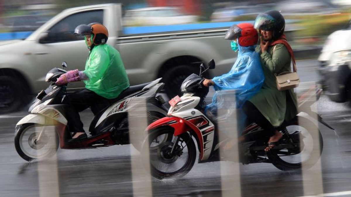


JAKARTA - The Meteorology, Climatology and Geophysics Agency (BMKG) predicts light to moderate rain to flush the majority of major cities in Indonesia even though the season has moved towards the dry season.
BMKG forecaster Nurul Izzah Fitria said the emergence of a phenomenon of slowing wind speed or convergence and wind or confluence encounters caused most areas to still experience rain.
"This condition is able to increase the potential for rain cloud growth around the cyclonic circulation area of convergence and convergence," he said in a statement quoted by ANTARA, Wednesday, May 29.
On the island of Sumatra, BMKG predicts the weather for major cities that experience light to moderate rain, namely Padang, Pekanbaru, Bengkulu, and Tanjung Pinang.
Cloudy to thick cloudy weather enveloped Bandar Lampung, Pangkal Pinang, Palembang, and Banda Aceh. Meanwhile, thunderstorms are predicted to only occur in Jambi.
The majority of big cities on the island of Java today are generally expected to be cloudy until cloudy. Cloudy skies are expected in Denpasar, light rain in Mataram and Kupang.
In Kalimantan, light rain is predicted to fall in Palangka Raya, Banjarmasin, and Samarinda. Cloudy weather in Pontianak and fog in Tanjung Selor. Then, Sulawesi Island is generally predicted to experience light to moderate rain, except for Gorontalo which is forecasted for thunderstorms.
The majority of major cities in eastern Indonesia also have the potential to experience light to moderate rain, except for Ambon which is thought to be cloudy. Nurul said that currently the cyclonic circulation is observed to be in the Makassar Strait area.
Meanwhile, convergence areas were observed extending in the northern part of East Kalimantan, the east coast of North Kalimantan, and the western waters of Lampung to West Sumatra.
Then on the southern coast of East Java, the north coast of Banten, the coast of Kalimantan, the Banda Sea, the Arafuru Sea, Central Papua, and West Papua.
In addition, confluency areas or wind gatherings were also observed in the Banda Sea, Halmahera Sea, Flores Sea, South China Sea, and East Nusa Tenggara to Banten Indian Ocean areas.
The prediction of surface winds in Indonesian territory is generally dominated by easterly winds with speeds ranging from 10 to 50 kilometers per hour.
The air temperature in Indonesia today ranges from 20 to 34 degrees Celsius with humidity ranging from 55 to 100 percent.
Meanwhile, the forecast for sea wave heights in Indonesia is generally quite conducive, ranging from 0.5 to 2.5 meters.
SEE ALSO:
-
 | OLAHRAGA
Justin Hubner dan Jay Idzes Absen Saat Timnas Indonesia Lawan Tanzania
29 Mei 2024, 00:05

The BMKG appealed to the public to be aware of the potential for high waves of about 2.5 to 4 meters which could potentially occur in the Indian Ocean in the western region of Sumatra, the Indian Ocean south of Java Island to south of West Nusa Tenggara.
"The potential for tidal flooding on the coast of the Riau Islands, the north coast of Jakarta, and the north coast of Central Java," he said.
The English, Chinese, Japanese, Arabic, and French versions are automatically generated by the AI. So there may still be inaccuracies in translating, please always see Indonesian as our main language. (system supported by DigitalSiber.id)
Most Popular Tags
#Prabowo Subianto #donald trump #Febrie Adriansyah #8791 #giias 2026Popular


