

North Maluku (Malut) Regional Disaster Management Agency (BPBD) warned residents and tourists not to move around the slopes of the Gamalama volcano.
The head of the North Maluku BPBD, Febhi Alting, said the warning was based on information on the results of monitoring in Ternate City.
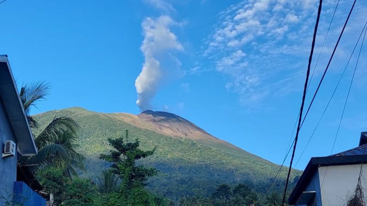
"Currently, the Gamalama volcano is observed to be white from the main crater smoke with a thin, medium to high intensity of about 20-300 meters from the summit. The weather is sunny to rainy, the wind is weak to strong north, northeast, southeast, south, and southwest," he said in Ternate, Thursday, April 18, which was confiscated by Antara.
The air temperature is about 24-31 degrees Celsius and humidity is 6-9180 based on a report by the Center for Volcanology and Geological Hazard Mitigation (PVMBG) of the Ministry of Energy and Mineral Resources on April 17, 2024.
In fact, the latest developments in increasing the activity of the Gamalama volcano from April 15, 2024, were recorded 25 times of gusts, 1 shallow volcanic earthquake, 28 times of deep volcanic earthquakes, 42 times of local tectonic earthquakes, 1 time the earthquake was felt and 234 times the tectonic earthquake was far away.
So, based on the results of observations, analysis of visual and instrumental data, carried out by officers of the Gamalama Volcano Monitoring Post, the activity of Mount Gamalama is still at level II or alert.
Therefore, in this regard, the North Maluku BPBD appealed to the Ternate City BPBD to increase coordination with related parties in anticipating the possibility of an eruption of Mount Gamalama, prepare resources and continue to monitor through the PVMBG of Ternate City.
He asked the people around Mount Gamalama and tourist visitors not to move within a radius of 1.5 KM from the main crater at the top of Mount Gamalama.
In the rainy season, people living in the direction of the river that originates in the Puncak Gamalama area always increase their awareness of the potential threat of secondary danger in the form of lava flows and continue to monitor the latest developments in Mount Gamalama's activities through trusted channels and are not affected by misleading information.
Meanwhile, Head of the PVMBG Geological Agency Hendra Gunawan said the volcano was clearly visible until it was covered with fog 0-II. Observed the smoke of the main crater is white with moderate to high intensity about 20-100 meters from the summit. The weather is cloudy to cloudy, the wind is weak to moderate to the north and northwest.
The English, Chinese, Japanese, Arabic, and French versions are automatically generated by the AI. So there may still be inaccuracies in translating, please always see Indonesian as our main language. (system supported by DigitalSiber.id)


