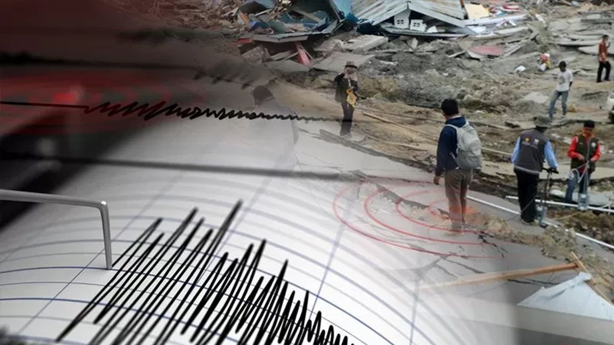


JAKARTA - The earthquake phenomenon on the island of Kalimantan was caused by a fault of earth rock that shifted from a passive direction to starting to divide into the island.
Geological Engineering Expert at the Faculty of Engineering, Lambung Mangkurat University (ULM), South Kalimantan, Adip Mustofa, said that geologically, there was a marketing of rocks from the Pacific to the island of Papua, then to Sulawesi Island, and began to divide the eastern part of Kalimantan Island.
"So, there were faults in some parts of Kalimantan that caused small-scale magnitude shocks," he said, quoting Antara.
Adi said that the rock fault activity in Kalimantan could not be predicted specifically when the time would occur, but as time went on, it was a natural phenomenon that had occurred since the rock era hundreds of millions of years ago.
The activity of rock fractures on the island of Kalimantan, he said, has been since the time of Jura, which at that time was the main period on a geological time scale that lasted about 165 million years ago. This is proof that the rocks in Kalimantan are no longer intact, because there have been fractures since ancient times.
Several weeks ago on the island of Kalimantan there were rock fractures that caused earthquakes in the eastern, southern, and central regions. Fish continued to the western region," he said.
According to him, the earthquake phenomenon that occurred some time ago in parts of South Kalimantan, East Kalimantan, and Central Kalimantan, which was recorded by BMKG more than six times in February 2024, was not the first time this had happened.
Adip explained that last year there was also an earthquake in Kalimantan, which according to the BMKG occurred due to rock shifting and targeting activities triggered by energy buildup, due to faults, causing earthquakes. In fact, in 1923, 1925, 1936, there has also been an uproar.
In addition, he continued, it should be noted that the area of South Kalimantan, which is known for its Meratus Mountains, stretches quite widely to the east, south, west, and north, has been identified by experts that there are hundreds of faults in the form of rock fractures with a length of up to 150 kilometers.
Adip said the danger is that if Meratus rocks are often active and the shift in fractures is increasingly swiping, it will store the energy that is getting bigger which causes strong shocks.
However, he said, until now there has been no research to prove when it happened, and the strength of earthquake vibrations in South Kalimantan is still relatively small on a scale ranging from magnitudes of two to five in a coma.
SEE ALSO:
-
 | BERITA
Ulang Tahun ke-64, Kaisar Jepang Doakan Warganya yang Menjadi Korban Gempa Bumi
24 Februari 2024, 06:35 -
 | BERITA
Turki Penjarakan Kontraktor Bangunan yang Runtuh Akibat Gempa Hingga 18,5 Tahun
24 Februari 2024, 00:04
He assessed that currently there is still a buildup of small, dense energy in South Kalimantan which is expected to cause small-scale earthquakes in the future.
Adip said that in general, the earthquake on the island of Kalimantan has not been considered very dangerous or has not had an extraordinary impact, so geologists have not been interested in conducting in-depth research related to the earthquake that occurred.
"There has been no research to prove when an earthquake occurred in Kalimantan, so we cannot make quite accurate predictions. However, the good news is that the magnitude of the earthquake in Kalimantan is relatively small," he said.
The English, Chinese, Japanese, Arabic, and French versions are automatically generated by the AI. So there may still be inaccuracies in translating, please always see Indonesian as our main language. (system supported by DigitalSiber.id)


