


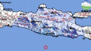
YOGYAKARTA - The Regional Disaster Management Agency (BPBD) of the Special Region of Yogyakarta (DIY) asked the public and tourists not to panic with information on the potential for a megathrust earthquake on the south side of DIY which is estimated to have a magnitude of 8.7.
"The public does not need to be afraid, there is no need to panic, and tourists do not need to refrain from coming to Yogyakarta," said Acting Head of BPBD DIY Noviar Rahmad as quoted by Antara, Saturday, August 19.
He said that BMKG information stating that the southern side of DIY has the potential for a megathrust earthquake to a magnitude of 8.7 and could cause a tsunami as high as more than three meters, is only potential.
According to him, natural disasters such as earthquakes are still a disaster that cannot be ascertained when it will occur.
"Once again this is potential, not predictions. Of course everyone must be vigilant, even at all times, because those who have the potential for megathrust are not only south of Java, but also west of Sumatra and south of Papua," he said.
Noviar said that so far DIY has also experienced small earthquakes so that tectonic plates can emit energy little by little which makes the potential for earthquakes with large strengths decrease.
Meanwhile, the Acting Head of the DIY Tourism Office Kurniawan ensured that until now the conditions of various tourist destinations on the southern side of DIY were still in a safe condition.
"Tourism in DIY, including on the south side, is still relatively safe. However, we certainly urge people who live or their daily activities close to the south coast to always be vigilant, as well as tourists who come," he said.
BMKG DIY Information Data Staff Ayu K Ekarsti explained that megathrust is a deep-sea fault that moves up (thrust) and is said to be mega because it is big and forms segments.
"There are two segments in the DIY area. Based on the modeling of the 2017 PusGen in the book Map of Sources and Dangers of the Indonesian Earthquake, it is stated that if an earthquake occurs in these two segments, it can cause an earthquake measuring 8.7 and trigger a tsunami. This modeling result has also been submitted at the time of the YIA construction FGD," he said.
SEE ALSO:
-
 | BERITA
Berpusat di Pacitan, Gempa Magnitudo 5.0 Buncang Jawa Timur tidak Berpotensi Tsunami
19 Agustus 2023, 06:32 -
 | BERITA
Gempa 5,7 Magnitudo di Samudera Hindia Selatan, Wilayah Banten Tidak Berpotensi Tsunami
17 Agustus 2023, 13:45 -
 | BERITA
BMKG Sebut Peningkatan Kegempaan di Yogyakarta Akibat Sesar Opak Masih Normal
15 Agustus 2023, 15:13

Ayu explained that the earthquake in the range of this fault was able to trigger a tsunami due to the movement of plate faults moving upwards.
The results of the modeling of the Yogyakarta BMKG, the tsunami that was generated based on the worst-case scenario of M 8.8 could reach 18-22 meters, with the time to arrive at the southern coast at the earliest of 34 minutes.
"But what is called an earthquake, even though it has a repeated period, its location can move around, depending on the accumulation of energy available. And we convey that this potential is not to scare the public. Instead, we want to educate, provide mitigation and preparedness," he said.
The English, Chinese, Japanese, Arabic, and French versions are automatically generated by the AI. So there may still be inaccuracies in translating, please always see Indonesian as our main language. (system supported by DigitalSiber.id)


