

JAKARTA - The National Research and Innovation Agency (BRIN) conducted research to find fault lanes or faults that triggered an earthquake with a magnitude of 5.6 in Cianjur Regency in November 2022.
"We are evaluating data on past research research, which has been available from many agencies, institutions, and universities. It is still unclear, the fault or fault or source of the earthquake that caused this Cianjur earthquake," said researcher at the Geological Disaster Research Center, BRIN's Ground and Maritime Research Organization, Bambang Sugiarto, quoted by ANTARA, Thursday, July 27.
Previously, the Meteorology, Climatology and Geophysics Agency (BMKG) released an earthquake that destroyed hundreds of buildings and claimed lives from the newly identified Cugenang Fault.
BMKG said the fault area was approximately nine square kilometers and made nine villages declared dangerous zones to live in, due to earthquake-prone.
Even though the BMKG has released it, BRIN said that the fault must be investigated more comprehensively and deeply in order to obtain more detailed data, especially the location of the fault path.
SEE ALSO:

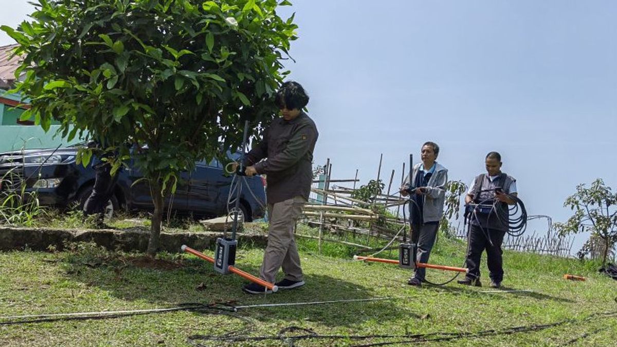
BRIN researchers suspect five points in four villages in Cugenang District which are locations for fault lanes based on monitoring geospatial. The five points later became research samples for BRIN researchers.
"It has not been found (location of faults). Because it is said to have been found, if the active fault parameter data is clear, where is the length, where is the coordinate point, which area is passing, where is the tilt, how deep is the depth, that's what we are doing," he said.
There are two methods used to search for locations suspected of being fault lanes, namely through the Geoelectric Multichanel Resistivity and Ground PenetratingRadar method.
Both methods are used to obtain a coating pattern below ground level.
"Later, we will combine the results whether the data from geoelectrics and georadars is exactly the same or not," he said.
The English, Chinese, Japanese, Arabic, and French versions are automatically generated by the AI. So there may still be inaccuracies in translating, please always see Indonesian as our main language. (system supported by DigitalSiber.id)
Most Popular Tags
#Prabowo Subianto #donald trump #2026 World Cup #bgn #konflik timur tengahPopular


