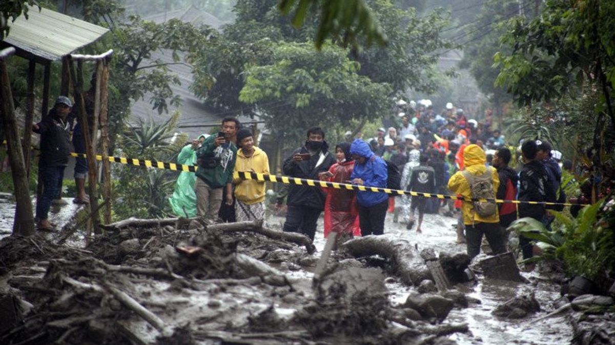


JAKARTA - Mitigation efforts in Gunung Mas Village in Tugu Selatan Village, Cisarua District, Bogor Regency, West Java Province (Jabar) must still be carried out considering the location has not been free from the threat of flooding.
The Geospatial Information Agency (BIG) said that the Gunung Mas area is naturally located in the outlet area (output) in the form of a material and water discharge route from the upstream area above it.
"So from the ecosystem side in this area there is a potential for flash floods to occur again at a later date," said the Coordinator of Thematic Geospatial Information for Disaster, Geospatial Information Agency (BIG), Ferrari Pinem, reported by Antara, Monday, January 25.
After the floods on January 19, the team from the Big Thematic Mapping and Integration Center conducted a rapid assessment. The village is in the Cisampay sub-watershed (DAS), which is part of the upstream Ciliwung watershed.
The hilly area at the top of Kampung Gunung Mas is a rain catchment area that looks like a bowl basin. The rain that was caught in the basin flowed through the water output point that passed through Kampung Gunung Mas.
According to BIG's study, the upstream area of the village is a source of material and the water flowing downward is on a steep to very steep slope (> 45 percent to> 60 percent) so that the gravitational force has the potential to bring the material down and cause damage.
Apart from the flow pattern and slope of the slope, the BIG team stated, another watershed morphometric factor that may affect the flash flood incidence in Gunung Mas is the radial (round) shape of the Cisampay Sub-watershed.
The characteristic of the round watershed causes the time of surface water concentration to go to a point almost simultaneously.
This means that if the rain is evenly distributed throughout the sub-watersheds, the rainwater which becomes the surface flow will meet at one flow meeting point at the same time relatively.
The flood-affected area in Gunung Mas is also a land system of rocky intermediate / alkaline mountains which is strongly inscribed with surface morphology in the form of eroded remnants of old volcanic activity.
The circular wall pattern and open to the northwest indicates the formation of an old crater from a volcanic eruption in the past.
Strato volcanic bodies are formed from layers of sediment material from volcanic activity such as lava and lava deposits.
The material remains found in the affected areas indicate that during the flash flood the material was carried along with the vegetation on the upper slopes.
Based on the results of the rapid assessment, BIG recommends strengthening mitigation and providing an early warning system for banjir bandang and landslides in the Gunung Mas area.
The English, Chinese, Japanese, Arabic, and French versions are automatically generated by the AI. So there may still be inaccuracies in translating, please always see Indonesian as our main language. (system supported by DigitalSiber.id)


