

The Center for Volcanology and Geological Disaster Mitigation stated that the volcanic activity of Mount Gamalama in Ternate City, North Maluku (Malut) was monitored visually and instrumentally from the Volcano Observation Post (PGA) experiencing an increase in seismic activity.
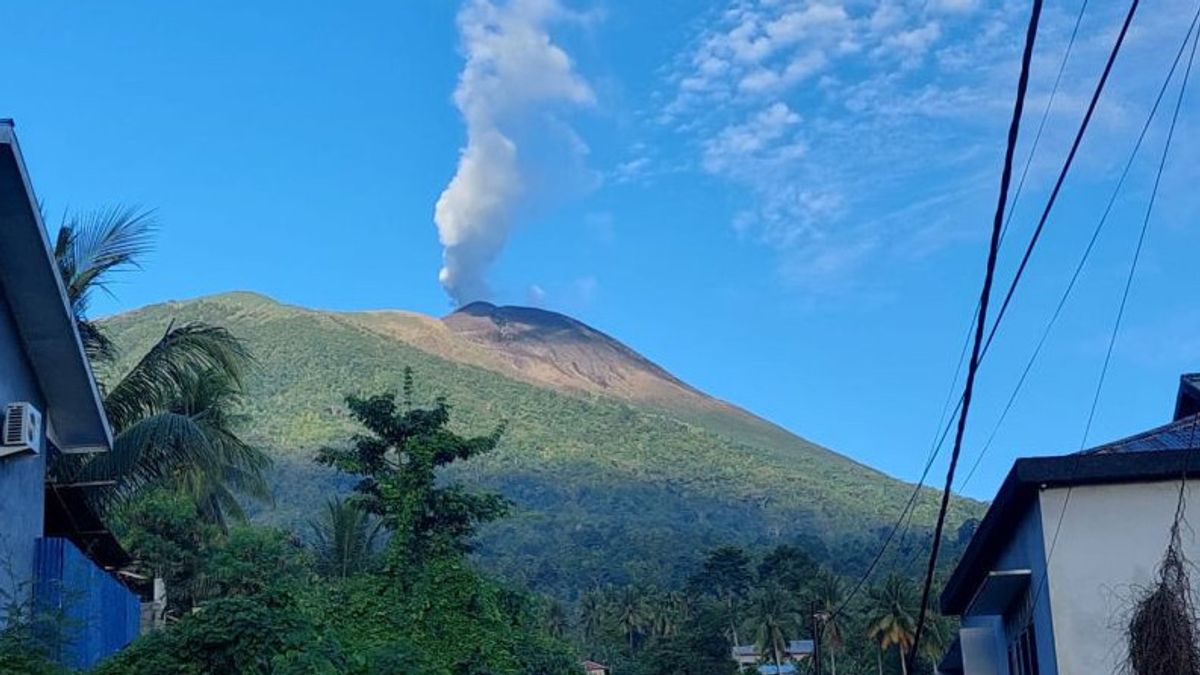
"The Concrete Volcanic Earthquake generally recorded 1 - 2 incidents per day. The crater smoke gusts are generally observed to be thin to thick white with a height of 10 300 meters above the peak, but are currently still at Level II since March 10, 2015," said Head of the Center for Volcanology and Geological Disaster Mitigation, Hendra Gunawan, as reported by ANTARA, Wednesday, May 3.
He stated that the earthquake of Mount Gamalama since January 2023 has been dominated by distant tectonic earthquakes, local tectonic earthquakes, and the Volcanic-Interior Earthquake (VA).
According to Hendra, Mount Gamalama experienced the last eruption on October 4, 2018, with a column height of 250 meters from the summit. Eruption characters generally occur in the central crater with a relatively short eruption precursor.
His party noted that the latest developments in the activity of Mount Gamalama until May 3, 2023 at 09.00 WIT included an increase in the Volcanic-Interior Earthquake (VA) from May 1, 2023.
On May 1, 2023, 11 times the Deep Volcanic Earthquake and on May 2, 2023, 14 times the Deep Volcanic Earthquake was recorded. On May 3, 2023 at 00.00 a.m. local time, the Volcanic-In, 1 time the Volcanic-Dangkal Earthquake, 5 times the gust earthquake, 1 time the Low Frequency Earthquake, and 5 times the Remote Tectonic Earthquake were recorded.
In addition, crater gust activity on May 1, 2023, was observed with gusts of thin white crater smoke with a height of 50 100 meters. The wind was weak to the west, southwest, north, and northeast.
Hendra stated that in general, the activity of Mount Gamalama from May 1 to 3, 2023 at 09.00 WIT, tends to fluctuate and is still dominated by deep vulcanic earthquakes and distant tectonic earthquakes related to regional tectonic activity around the Halmahera archipelago.
However, in such conditions and given the characteristics of the precursor of the eruption of Mount Gamalama, the potential danger that is likely to occur is the Freatic Eruption with a threat of danger for now in the form of material ejections from the main crater hitting the region with a radius of 1.5 km from the center of the eruption.
In addition, light ash rain can occur with distance and intensity depending on the direction and speed of the wind.
Based on the results of observations, analysis of visual and instrumental data until May 03, 2023 at 12.00 WIT, the activity level of Mount Gamalama is still at level II.
PVMBG urges people around Mount Gamalama and visitors / tourists not to be allowed to carry out activities / approach within a radius of 1.5 km from the crater / peak.
Meanwhile, during the rainy season, people living around the river that originates at Mount Gamalama are asked to be aware of the potential threat of lahar hazard.
The English, Chinese, Japanese, Arabic, and French versions are automatically generated by the AI. So there may still be inaccuracies in translating, please always see Indonesian as our main language. (system supported by DigitalSiber.id)
Most Popular Tags
#Prabowo Subianto #donald trump #2026 World Cup #venezuela #konflik timur tengahPopular


