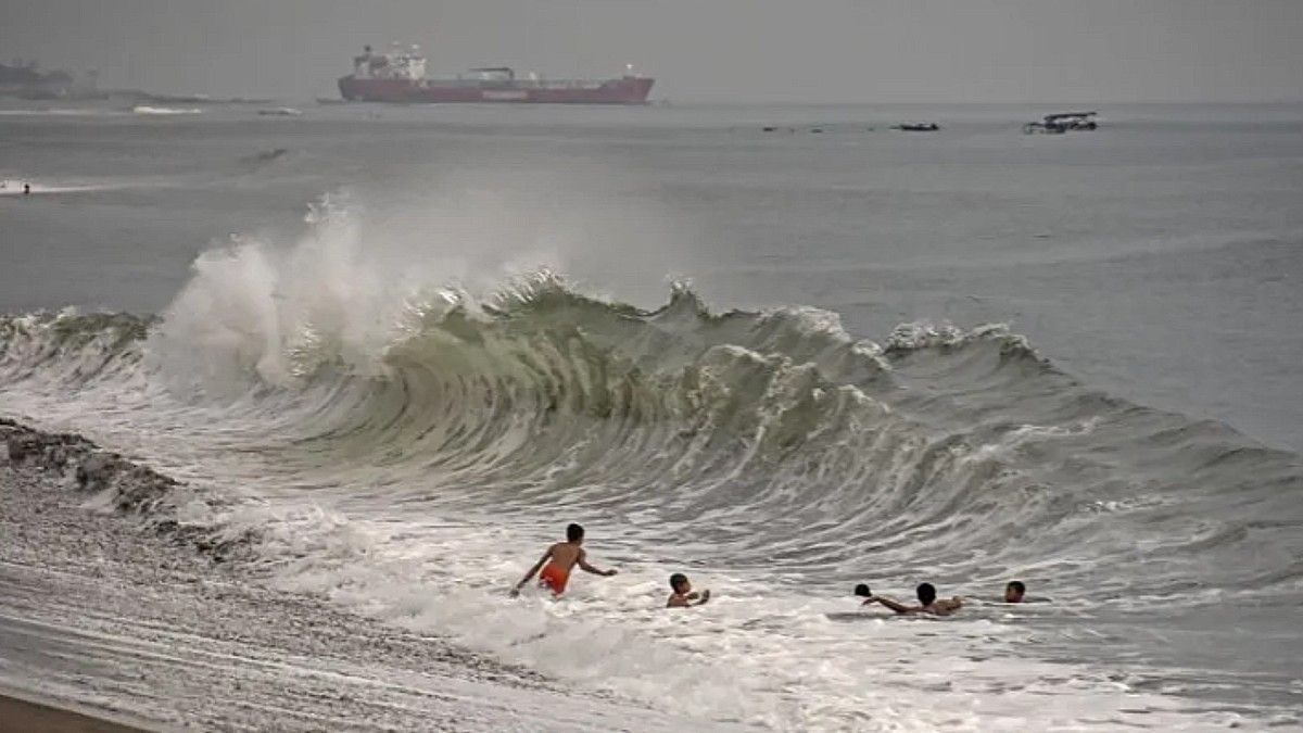


JAKARTA - The Meteorology, Climatology and Geophysics Agency (BMKG) has asked the people of the southern coast of Kupang-Rotte Island, North Natuna Sea, and a number of other areas to be aware of the potential for high waves of up to six meters in several Indonesian waters.
Head of the Maritime Meteorology Center, BMKG, Eko Prasetyo said, high waves have the potential to occur on January 3-5, 2023. Considering wind pattern data in Indonesian territory.
"We ask people who live and work on the coast around areas where high waves are likely to occur so that they remain vigilant," he said in Jakarta, Tuesday, January 3, as reported by Antara.
He revealed that the wind pattern in northern Indonesia is dominantly moving from the Northwest-Northeast with wind speeds ranging from 6-20 knots, while in southern Indonesia, the dominant movement is from Southwest-Northwest with wind speeds ranging from 8-35 knots.
The highest wind speed was observed in the eastern Java Sea, South Indian Ocean, Central Java, South Indian Ocean Kupang, Savu Sea, Kupang-P. Rote waters, P. Sabu waters, Timor Sea, western Arafuru Sea, and Savu Sea.
This condition, said Eko Prasetyo, led to an opportunity to increase waves as high as 1.25-2.5 meters in northern Sabang waters, western waters of P. Simeulue, West Indian Ocean Aceh-P. Simeulue, Bengkulu waters, southern Lampung Bay, northern Sunda Strait, Ombai-Selat Wetar Strait, eastern Bintan waters, Natuna Sea, Bangka Belitung waters, Karimata Strait, southern Kalimantan waters, western Java Sea, waters north of West Java.
Similar conditions also have the potential to occur in the southern waters of Baubau, Bone Bay, southern Makassar Strait, southern waters of Kep. Wakatobi, waters of Sangihe-Kep. Talaud, eastern Sulawesi Sea, Bitung-Kep waters. Sitaro, Maluku Sea, northern waters of Kep. Sula, waters of Halmahera Island, Halmahera Sea, northern waters of Raja Ampat-Jayapura, North Pacific Ocean Halmahera-Jayapura, northern Banda Sea, waters of Kep. Kai-Kep. Aru.
For waves in the higher range of 2.5-4 meters, it is likely to occur in the waters of P. Enggano, the western waters of Kep. Mentawai-Lampung, West Indian Ocean Kep. Mentawai-Lampung, western and southern Sunda Strait, southern waters of P. Java-Bali, South Indian Ocean Banten-Central Java, Bali Strait, Lombok, southern Alas, southern Sape Strait.
Furthermore, the northern part of the Sawu Sea, northern waters of Kupang-P. Rotte, waters of Kep. Anambas-Natuna, the central part of the Java Sea, waters north of Central Java-East Java-Kep. Kangean, Bali Sea-Laut Sumbawa, waters of Sep. Selayar, Flores Sea, southern Banda Sea, waters of Kep. Sermata-Kep. Tanimbar, Arafuru Sea.
Meanwhile, in very high waves 4-6 meters are likely to occur in the South Indian Ocean, East Java-NTT, Timor Sea, waters P. Sabu, western Sumba Strait, southern waters of Kupang-P. Rotte, southern Savu Sea, southern Lombok-Sumbawa waters, western waters of P. Sumba, North Natuna Sea.
In the midst of this condition, Eko Prasetyo asked to pay attention to high risks to shipping safety such as fishing boats (wind speeds of more than 15 knots and wave heights above 1.25 meters), barges (wind speeds of more than 16 knots and wave heights above 1.5 m).
In addition, ferries (wind speeds of more than 21 knots and wave heights above 2.5 m), large ships such as cargo ships/cruise ships (wind speeds of more than 27 knots and wave heights above 4 m).
The English, Chinese, Japanese, Arabic, and French versions are automatically generated by the AI. So there may still be inaccuracies in translating, please always see Indonesian as our main language. (system supported by DigitalSiber.id)
Most Popular Tags
#Prabowo Subianto #donald trump #Febrie Adriansyah #8791 #giias 2026Popular


