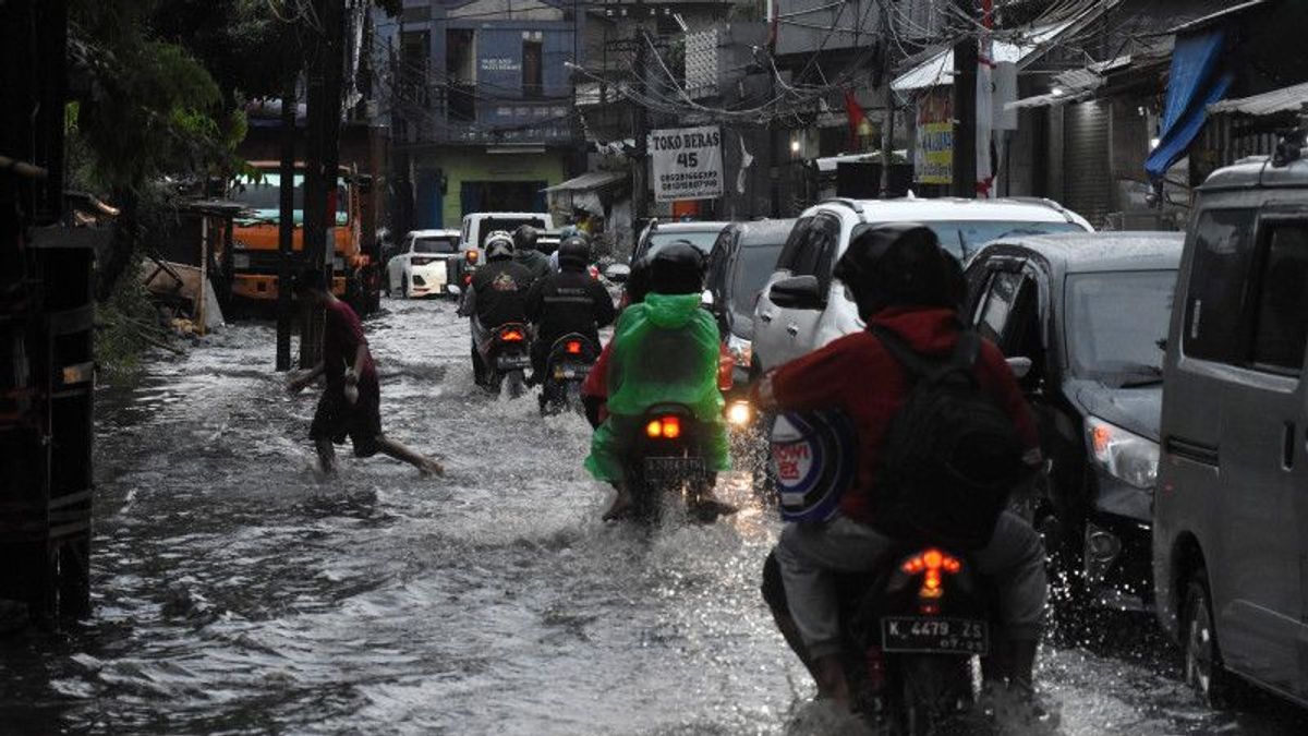
JAKARTA - A 30-35 cm high puddle of water at the TransJakarta Duren Tiga Bus Stop, Jalan Mampang Prapatan Raya, South Jakarta, has reportedly receded.
The Head of the DKI Jakarta Regional Disaster Management Agency (BPBD), Isnawa Adji, said that the receding water could not be separated from the handling of officers. In addition, stopped rain is also a factor.
"The inundation at the Duren Tiga Busway Busway Bus Stop is about 30-50 cm, and has been handled. We have also confirmed with the Transportation Agency, currently the inundation there has receded," Isnawa said in a short message, as reported by Antara, Saturday, November 5.
Isnawa explained that in handling puddles at the location BPBD officers and the South Jakarta Water Resources (SDA) Sub-dept., had been in place since noon and the SDA mobile pump and fire engines were extracted.
"The inundation has receded as the rain begins to stop," he said.
The inundation at the Duren Tiga Bus Stop itself was via a video taken by a netizen named Henni Veronica Joentak which was then uploaded by the Instagram account @jktinfo at around 14.00 WIB, with the caption reading "Saturday (5/11) Monitoring from the Duren three Mampang Bus Stop this afternoon".
Based on information from the DKI Jakarta BPBD until 15:00 WIB, apart from the Duren Tiga Bus Stop area, there are still six roads inundated and 68 RT or 0.223 percent of the 30,470 RT in the DKI Jakarta area.
Isnawa explained that his party coordinated with various elements responsible for handling floods in DKI Jakarta to overcome inundation.
"For the suction of inundation. I also remind fellow lurah, RW, RT and PPSU officers so that in the rainy season often check the existing channels or water lines that work properly," said Isnawa.
The data for the affected areas that are still inundated are as follows:
South Jakarta has 68 RTs consisting of:
Bintaro-Sumber Village: 2 Neighborhoods- Altitude: 40 to 50 cm- Cause: High rainfall and overflow of Pesanggrahan River
Pesanggrahan Village- Summary: 11 RT- Altitude: 50 cm- Cause: High rainfall, overflow of Pesanggrahan Rivers and Money Rivers
North Cipete Village- Summary: 3 RT- Altitude: 50 to 70 cm- Cause: High rainfall and overflow of Krukut River
Petogogan- Total Village: 38 RT- Altitude: 75 cm- Cause: High rainfall and overflow of Krukut River
Cipulir Village- Summary: 1 Neighborhood- Altitude: 100 cm- Cause: High rainfall and overflow of Pesanggrahan River
Kelurahan Kebayoran Lama Utara- Jumlah: 1 RT- Ketinggian: 40 cm- Penyebab: Curah hujan tinggi dan luapan Kali Grogol
Kelurahan Gandaria Selatan- Jumlah: 3 RT- Ketinggian: 75 cm- Penyebab: Curah hujan tinggi dan luapan Kali Grogol
East Cilandak Village- Number: 2 RT- Altitude: 110 cm- Cause: High rainfall and overflow of Krukut River
Tegal Parang- Jumlah Village: 7 RT- Altitude: 50 to 60 cm- Cause: High rainfall and overflow of Mampang River.
Six roads in DKI Jakarta are flooded:
1. Jl. Ciledug Raya (SESKOAL), South Jakarta Altitude: 30 cm
2. Jl. Dharmawangsa Raya Kebayoran Baru District, South Jakarta Altitude: 20 cm
3. Ciledug Raya Street Kebayoran Lama District, South Jakarta Altitude: 40 cm
4. Jl. Health Raya Pesanggrahan District, South Jakarta Altitude: 50 cm
5. Jl.Health VI Pesanggrahan District, South Jakarta Altitude: 30 cm
6. Kemang Raya Street Mampang Prapatan District, South Jakarta Altitude: 40 cm
The English, Chinese, Japanese, Arabic, and French versions are automatically generated by the AI. So there may still be inaccuracies in translating, please always see Indonesian as our main language. (system supported by DigitalSiber.id)
