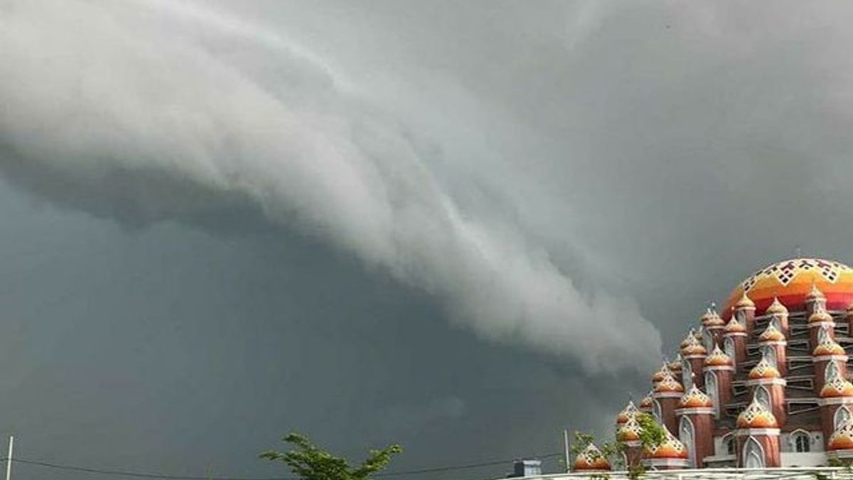


MAKASSAR- Photos and videos of a collection of clouds rolling like a tsunami wave are being distributed at Sultan Hasanuddin Maros Airport, Makassar to Pangkep Regency, South Sulawesi.
The appearance of a cloud similar to a tsunami wave was recorded by a person who was inside Sultan Hasanuddin Airport, Maros. Another photo shows a cloud in the area of the 99 Dome of the CPI Makassar Mosque, on Jalan Perintis Kemerdekaan Makassar in Pangkep Regency. These photos are also uploaded to the regional information Instagram account.
The Head of Data and Information Division of the Center for Meteorology, Climatology and Geophysics Region IV - Makassar, Hanafi Hamzah, explained that natural events, namely clouds in the form of tsunami waves, start from cumulus clouds (in the form of cauliflower) and develop into towering cumulonimbus clouds that are very high, dense in the clouds.
Cumulonimbus clouds are formed due to atmospheric instability. These clouds can form alone or in groups.
"So the cloud has various shapes. Some are in the form of cabbage, some are shaped like chicken feathers, some are in the form of fibers, some are in the form of curling. So that is called cumulus, it will develop into a towering cloud, the name is cumulonimbus, "said Hanafi Hamzah, Head of the Data and Information Division of the Center for Meteorology, Climatology and Geophysics Region IV - Makassar, contacted by VOI, Monday, December 7.
He explained that cumulonimbus clouds are towering vertical clouds that are very high dense, in which they contain thunderstorms and cold weather.
"So in cumulonimbus, this is in its activity, if it is in ripe conditions it can create heavy rain, strong winds, then it can be accompanied by a thunderstorm," he continued.
The English, Chinese, Japanese, Arabic, and French versions are automatically generated by the AI. So there may still be inaccuracies in translating, please always see Indonesian as our main language. (system supported by DigitalSiber.id)
Most Popular Tags
#Prabowo Subianto #donald trump #2026 World Cup #Febrie Adriansyah #8791Popular


