

JAKARTA - The Meteorology, Climatology and Geophysics Agency predicts that Goni's tropical cyclone is predicted to move away from Indonesia in the next 24 hours.
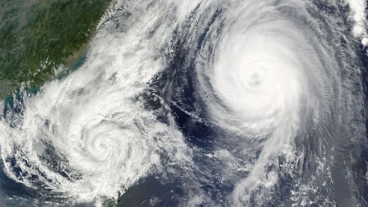
It is known, this cyclone appears in the Pacific Ocean. Burlap's tropical cyclones can trigger high waves in the water, heavy rain and strong winds.
Even though the cyclone is moving away, Head of the Center for Disaster Data, Information and Communication of the National Disaster Management Agency (BNPB) Raditya Jati said, there are indirect impacts that can still be felt in Indonesia.
"Despite moving away from Indonesian territory, the tropical cyclone Goni still has an indirect impact on the weather in the country," Raditya said in a written statement, Sunday, November 1.
Raditya said that the impact was moderate to heavy rain that could occur in the regions of North Kalimantan, East Kalimantan, Central Kalimantan, North Sulawesi and Central Sulawesi.
"Then, sea waves with a height of 4.0-6.0 meters also have the potential to occur in the waters of the South China Sea," said Raditya.
Raditya appealed to the public and policy makers in the regions, especially those areas that are predicted to be indirectly affected to continue to raise awareness.
Raditya also recommended that local governments strengthen the capacity of their staff by maximizing the potential of human resources, to take necessary actions based on disaster risk reduction.
"In this case, natural disasters that can occur and be triggered by weather factors such as floods, flash floods, tornadoes, strong winds and landslides need to be prevented and anticipated properly so that they do not cause casualties," he explained.
As is known, the position of the Goni tropical cyclone is at 13.5 North Latitude, 123.6 East Longitude or about 1,150 kilometers north of Tahuna, North Sulawesi.
Currently, the direction of movement is towards the west and southwest at a speed of 15 knots or 27 kilometers per hour, away from Indonesia. Its strength reaches 90 knots or 175 kilometers per hour and has a pressure of 960 hPa.
Based on prediction analysis 24 hours ahead until Monday, November 2 at 07.00 WIB, the position of the cyclone is at 15.2 LU 118.4 East Longitude or about 1,530 kilometers north and northwest of Tahuna, North Sulawesi.
For the direction of the cyclone's movement heading west and northwest at a speed of 15 knots or 27 kilometers per hour. Meanwhile, its strength has weakened from the previous 45 knots or 85 kilometers per hour and the pressure has increased to 994 hPa.
The English, Chinese, Japanese, Arabic, and French versions are automatically generated by the AI. So there may still be inaccuracies in translating, please always see Indonesian as our main language. (system supported by DigitalSiber.id)


