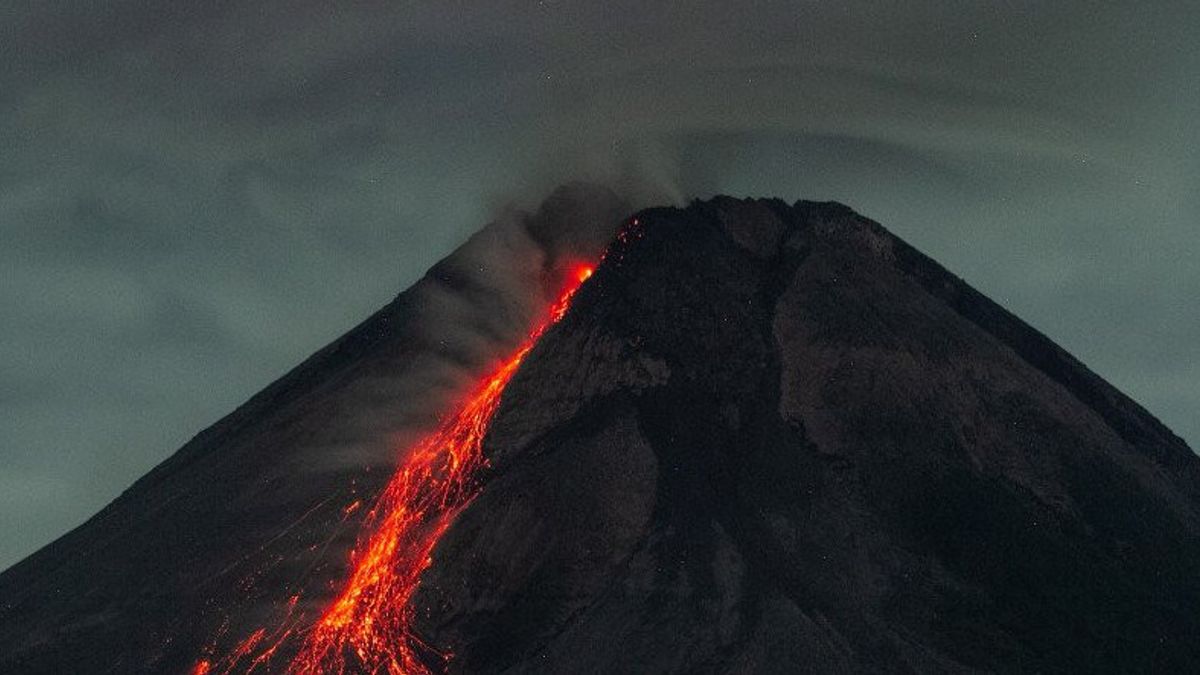


YOGYAKARTA - The Geological Disaster Technology Research and Development Center (BPPTKG) stated that Mount Merapi on the border of the Special Region of Yogyakarta and Central Java released incandescent lava seven times on Friday 27 May. ) to the southwest from 00.00 to 06.00 WIB. According to the Head of BPPTKG, Hanik Humaida during the observation period Merapi also experienced 37 avalanches with an amplitude of 3-30 mm for 25-170 seconds, one gust earthquake with an amplitude of 6 mm for 18 seconds, and one multi-phase earthquake with an amplitude of 3 mm for 7 seconds. On Friday 27 May morning, white smoke from the weak pressure crater was observed with a white color with medium intensity and 20-50 meters high above the crater peak. Previously, on Thursday 26 May BPPTKG recorded three hot clouds of avalanches sliding from Mount Merapi with a sliding distance of 1600-2000 meters and 18 times of incandescent lava sliding a maximum of 2,000 meters. to the southwest. Until now BPPTKG still maintains the status of Mount Merapi at Level III or Siaga. Falling lava and hot clouds from Mount Merapi can have an impact on areas in the south-southwest sector which include the Boyong River (a maximum of five km) and the Bedog River , Krasak, Bebeng (a maximum distance of seven km). In addition, lava flows and hot clouds from Mount Merapi can impact areas in the southeast sector which include the Woro River (a maximum of three km) and the Gendol River (a maximum of five km). The fire experienced an explosive eruption, so the ejection of volcanic material could reach an area within a radius of three kilometers from the top of the mountain.
The English, Chinese, Japanese, Arabic, and French versions are automatically generated by the AI. So there may still be inaccuracies in translating, please always see Indonesian as our main language. (system supported by DigitalSiber.id)
Most Popular Tags
#Prabowo Subianto #donald trump #2026 World Cup #bgn #konflik timur tengahPopular


