

LAMPUNG - Mount Anak Krakatau (GAK) in the waters of the Sunda Strait, between the provinces of Banten and Lampung, has increased its status to level III from the previous level II.
"The status of GAK has been upgraded from level II to level III since Sunday, April 24 at 18.00 WIB," said GAK Monitoring Post Officer in South Lampung, Andi when contacted from Bandarlampung, Antara, Monday, April 25.
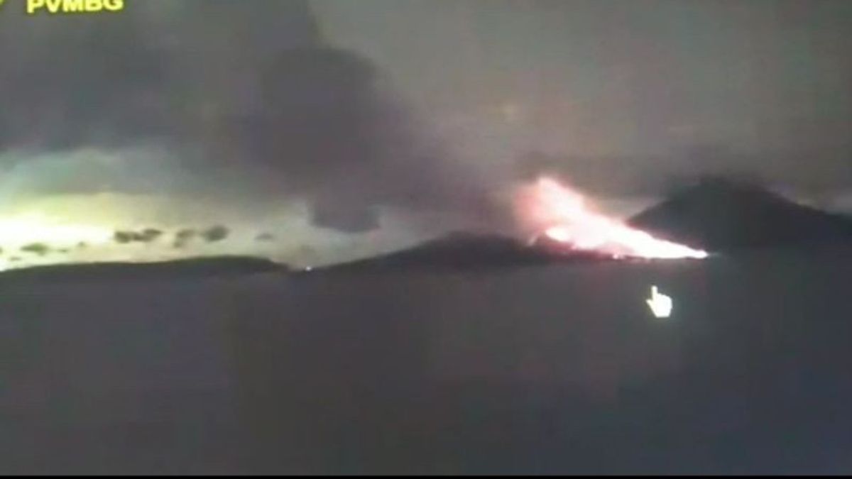
On Sunday from the Monitoring Post, Mount Anak Krakatau was heard making a roar and also continuing to erupt with fire.
"The GAK eruption on Sunday reached a height of 3,000 meters, and the fire rays reached a maximum of 200 meters from the top of the mountain," he said.
He also appealed to the public, especially fishermen and tourists, not to approach GAK within a 5 kilometer radius in a level III situation.
However, the community is still able to carry out their activities and not be consumed by irresponsible issues related to GAK.
"The community can contact the local BPBD or go to the GAK Monitoring Post to find out the status and situation. For this morning GAK experienced a decline in activity, but we will continue to monitor its progress," he said.
Meanwhile, based on an official release issued by the Indonesian Ministry of Energy and Mineral Resources (ESDM), the seismicity of Mount Anak Krakatau during 1-24 April 2022 was marked by the recording of 21 earthquake eruptions.
Then, 155 gust earthquakes, 14 harmonics, 121 low frequency earthquakes, 17 shallow volcanic earthquakes, 38 deep volcanic earthquakes, and continuous tremors with an amplitude of 0.5 - 55 mm (dominant 50mm) and recorded 2 local tectonic earthquakes, 6 times of Far Tectonic earthquakes and 1 felt earthquake with a scale of I MMI.
The energy of volcanic activity as reflected in the RSAM (real-time seismic amplitude measurement) value shows a fluctuating pattern with a tendency to increase sharply since April 15, 2022.
Then, by visual observation, the height of the puff of smoke during the period 1 - 24 April 2022 from the direction of the Pasauran and Kalianda PGA Posts and from CCTV is generally clear until it is covered in fog.
When the weather is clear, a puff of white crater smoke is observed with thin to thick intensity, the height of the gust column is about 25 – 3,000 meters from the top of the GAK peak, with weak to strong winds to the north, northeast, east, southeast, south, southwest, west and northwest.
Then, an eruption with a column height of 50 - 2,000 meters was observed from the top of the mountain. The eruption ash column is white, gray to black with the dominant wind direction to the southeast and south.
The English, Chinese, Japanese, Arabic, and French versions are automatically generated by the AI. So there may still be inaccuracies in translating, please always see Indonesian as our main language. (system supported by DigitalSiber.id)
Most Popular Tags
#Prabowo Subianto #donald trump #2026 World Cup #venezuela #konflik timur tengahPopular


