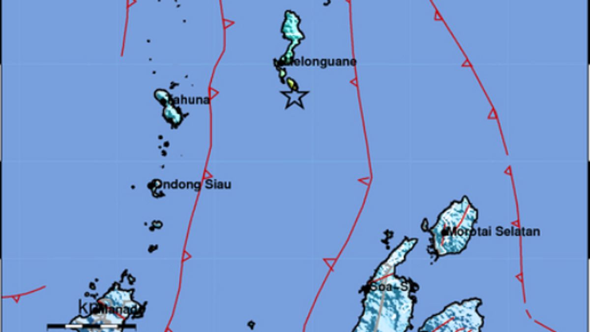


JAKARTA - The Meteorology, Climatology and Geophysics Agency (BMKG) said an earthquake with a magnitude of 6.1 rocked North Sulawesi, Saturday, at 09.26 a.m. with the epicenter 39 kilometers southeast of Melonguane in the Talaud Islands at a depth of 12 kilometers.
According to information received from the BMKG in Jakarta, Saturday, January 22, the location of the earthquake was at 3.67 north latitude and 126.82 east longitude, as quoted from the BMKG Twitter account.
The quake's location was 39 kilometers southeast of Melonguane, 147 kilometers northeast of Tahuna in the Sangihe Islands, 192 kilometers from Ondong in the Sitaro Islands in North Sulawesi. The location of the earthquake was also 325 kilometers northwest of Ternate, North Maluku.
In a statement, the BMKG confirmed that the earthquake did not have the potential for a tsunami.
The English, Chinese, Japanese, Arabic, and French versions are automatically generated by the AI. So there may still be inaccuracies in translating, please always see Indonesian as our main language. (system supported by DigitalSiber.id)


