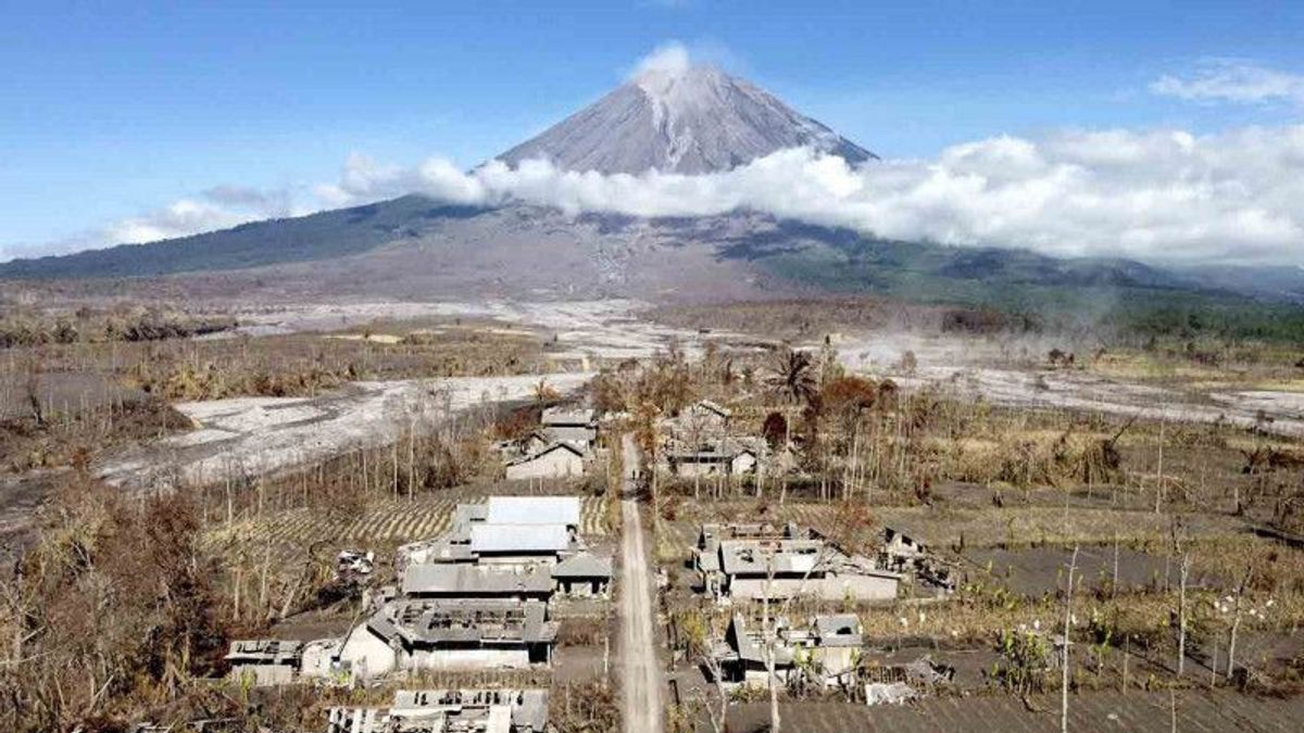


LUMAJANG - Mount Semeru's cold lava flood discharge that flows in a number of watersheds (DAS) has increased due to heavy rains that flushed Lumajang Regency, East Java, Monday afternoon to evening.
"Based on information from the Mount Semeru Monitoring Post officer on Mount Sawur, it was stated that flood vibrations were recorded on Monday from 11.39 WIB to 17.50 WIB," said Head of the Emergency Rehabilitation and Reconstruction Division at the Lumajang Regional Disaster Management Agency (BPBD), Joko Sambang. quoted by Antara, Monday, January 17th.
The cold lava flood of Mount Semeru is still crossing its path and has not yet overflowed into roads and settlements, but the water discharge has increased significantly.
"We urge people who are on the banks of rivers that originate from Mount Semeru to increase their alertness and vigilance, so it is better to stay away from riverbanks," he said.
Joko explained that officers and volunteers carried out continuous monitoring of the swift flow of Mount Semeru's cold lava flood because it was feared that it would overflow into residential areas.
"The cold lava flood discharge is quite heavy in Besuk Lengkong in the hamlet of Curahkobokan, so residents downstream are asked to always be alert and alert to the threat of flooding," he said.
Based on data from PPGA Semeru on Mount Sawur for the period Monday at 12.00 - 18.00 WIB, the activity of the mountain which has a height of 3,676 meters above sea level is visually clear, thick white crater smoke is observed with a height of 300 meters.
For seismic activity, five eruptions were recorded, four gusts were recorded, and flood vibrations were recorded once with an amplitude of 35 mm for 2,520 seconds.
The highest mountain on the island of Java has a Level III or Alert status, so people are not allowed to carry out any activities in the southeast sector along Besuk Kobokan, as far as 13 km from the summit (the center of the eruption).
Beyond this distance, the community is asked not to carry out activities at a distance of 500 meters from the river bank (river border) along Besuk Kobokan because it has the potential to be affected by the expansion of hot clouds and lava flows up to a distance of 17 km from the summit.
The community is also asked not to move within a 5 km radius from the crater/peak of Mount Semeru because it is prone to the danger of throwing stones (incandescent) and to be aware of the potential for hot clouds of avalanches (APG), lava avalanches and lahars along the river that originates at the summit of Mount Semeru.
The English, Chinese, Japanese, Arabic, and French versions are automatically generated by the AI. So there may still be inaccuracies in translating, please always see Indonesian as our main language. (system supported by DigitalSiber.id)


