

JAKARTA - The Meteorology, Climatology, and Geophysics Agency (BMKG) has monitored earthquake activity in North Halmahera, which has occurred more than 61 times since January 8-10, 2022 in various magnitudes and depths.
"If you look at the pattern of activity, the North Halmahera earthquake could lead to swarm activity," said the BMKG Earthquake and Tsunami Mitigation Coordinator, Daryono in a short message received in Jakarta, as reported by Antara, Monday, January 10.
Earthquake swarm is a series of earthquake activity with relatively small magnitude, with a very high frequency of occurrence, lasting for a relatively long time in a very local area.
In the last two days, there have been four significant earthquakes in North Halmahera, namely on Saturday, January 8 with a magnitude of 5.1, on Sunday, January 9 with a magnitude of 4.5, and Monday, January 10, twice with a magnitude of 5.2 at 4:27 WIB and a magnitude of 5.4 at 4:59 western Indonesia time.
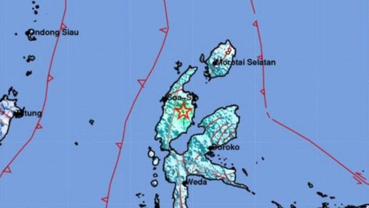
The strongest earthquake that occurred on Monday morning had a magnitude of 5.4 with the epicenter located at coordinates 1.52 degrees North Latitude (LU) – 127.86 degrees East Longitude (BT), precisely on land with a depth of 10 km.
SEE ALSO:
-
 | BERITA
KPK Temukan Bukti Dugaan Suap Wali Kota Bekasi Usai Geledah Kantor Hingga Rumah Dinas
08 Januari 2022, 16:02


Taking into account the location of the epicenter and the depth of the hypocenter, it is tentatively assumed that the North Halmahera earthquake of magnitude 5.4 was a shallow earthquake caused by active fault activity with a strike-slip-fault mechanism.
The impact of this earthquake was felt strongly in Kao, West Tobelo and Tobelo on the MMI IV intensity scale. Meanwhile, in Sofifi and Galela it was on the III-IV MMI intensity scale, and in Ternate, Wasile and Halmahera it was on the East III MMI intensity scale.
The series of earthquakes that occurred were reported to have caused damage to several houses of residents of Soa Maetek Village, West Kao District, North Halmahera Regency.
North Halmahera is an earthquake-prone area. The historical record of a strong earthquake that ever occurred in the area closest to the epicenter was a destructive earthquake in North Halmahera on October 14, 1944, with a magnitude of 6.6 at a depth of 15 km. This shallow crust earthquake triggered damage up to the MMI VII intensity scale.
"The public is advised to remain calm and not be influenced by issues that cannot be justified and do not occupy buildings that have been damaged or partially damaged by the earthquake, because if there is a significant aftershock, it is feared that the house may collapse," he said.
The English, Chinese, Japanese, Arabic, and French versions are automatically generated by the AI. So there may still be inaccuracies in translating, please always see Indonesian as our main language. (system supported by DigitalSiber.id)


