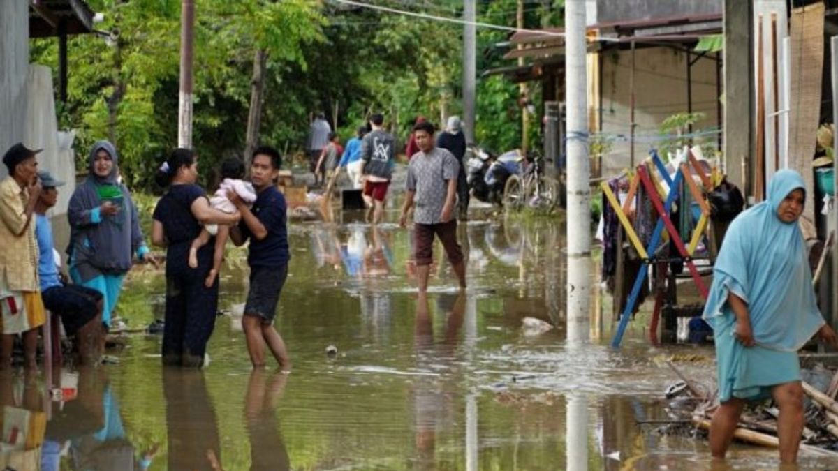


JAKARTA - The Meteorology, Climatology and Geophysics Agency (BMKG) predicts that there are 12 areas in Indonesia that have the potential to experience flooding to flash floods which can be classified in the alert category.
“The potential for moderate to heavy rain is still quite high for the next week. If specific, there are several areas that are quite vulnerable where extreme weather will have an impact on disasters," said Head of the BMKG Weather Prediction and Early Warning Division Miming Saepudin when contacted in Jakarta, Friday.
Miming said that for the next three days, based on impact-based weather forecasts, the 12 areas with the potential for flooding are Jambi, South Sumatra, Bangka Belitung Islands, Lampung, Banten, West Java, Central Java, East Java, West Kalimantan, South Kalimantan, East Kalimantan and Central Kalimantan.
Floods and flash floods which are included in the alert category are predicted to occur because weather conditions in several parts of Indonesia have shown an increase in the last few days.
The increase in weather is thought to be triggered by the active dynamics of the global La Nina scale atmosphere, which causes atmospheric conditions in the Indonesian region to become relatively wetter.
This situation is also reinforced by the activity of the MJO (Madden Jullian Oscillation) atmospheric wave phenomenon, the Kelvin wave, and the Rossby wave, which are currently active in Indonesia for the next week.
Miming explained that the MJO and the Kelvin wave will move from the Indian Ocean to the Pacific Ocean through Indonesia with a cycle of 30 to 40 days on the MJO, while the Kelvin is on a daily scale. On the other hand, the Rossby wave is also expected to move from the Pacific Ocean to the Indian Ocean.
“This is still quite active in Indonesia, which has the potential to increase the growth of rain clouds. Which of course can have an impact on increasing high rainfall weather in Indonesia, especially in the areas of Java, Bali, Nusa Tenggara like that," he said.
According to Miming, the unstable local-scale atmospheric dynamics with a high potential for convectiveness contributed to the formation of rain clouds which became a triggering factor for extreme weather.
The formation of rain clouds is predicted to form cumulonimbus clouds, so the potential for heavy rain with moderate to heavy intensity will occur in the next week period starting from November 5 to November 11, 2021.
Seeing the predictions of extreme rain that will occur for some time, Miming asked the entire community to increase their awareness of the potential for the weather.
He advised all parties to ensure the capacity and management of water that is ready to accommodate increased rainfall and ensure water channels and drainage to prevent blockages when there is an overflow of puddle water. In addition, it is hoped that the public will continue to follow the latest information from the BMKG.
"Monitoring the identified environmental conditions can result in catastrophic disasters such as floods or landslides and other matters related to the anticipation and mitigation of such disasters," he said, providing advice on preventing potential floods.
The English, Chinese, Japanese, Arabic, and French versions are automatically generated by the AI. So there may still be inaccuracies in translating, please always see Indonesian as our main language. (system supported by DigitalSiber.id)


