

YOGYAKARTA - The Meteorology, Climatology and Geophysics Agency (BMKG) shared the latest news regarding the development of Tropical Cyclone Narelle, which is currently being monitored in the southern region of Indonesia.
This system is predicted to have an indirect impact on weather and water conditions in Indonesia until March 27, 2026.
The following is a complete explanation of Tropical Cyclone Narelle and its impact on the weather in Indonesia.
Getting to know Tropical Cyclone NarelleReferring to the report of the Jakarta Tropical Cyclone Warning Center (TCWC) on March 25, 2026 at 07.00 WIB, Tropical Cyclone Narelle is the development of Tropical Cyclone 96P which reached tropical cyclone intensity on March 17, 2026 at 13.00 WIB.
The latest analysis on Thursday, March 26, 2026 at 07.00 WIB showed that the position of Tropical Cyclone Narelle was in the Indian Ocean, south of East Nusa Tenggara (NTT), at coordinates 17.2 degrees South Latitude (LS) and 120.4 degrees East Longitude (BT), or about 760 kilometers southwest of Sabu Island.
BMKG said that this system is moving southwest at a speed of about 9 knots (17 km/h), away from the Indonesian region with a maximum wind speed recorded at 85 knots (155 km/h).
Meanwhile, the maximum air pressure in the center of the cyclone was recorded at around 954 hPa, putting it in category 3.
In the next 24 hours, Tropical Cyclone Narelle will be in the western Indian Ocean of Australia, with coordinates 22.4 degrees LS, 113 degrees BT, about 1600 km southwest of Sabu.
The cyclone is moving southwest at a speed of 11 knots (21 km/h), away from the Indonesian region with a maximum wind speed of 100 knots (185 km/h).
The maximum air pressure at the center of the cyclone was recorded at around 939 hPa, placing it in category four.
Impact of Tropical Cyclone Narelle on Weather in IndonesiaQuoted from the BMKG official website, Tropical Cyclone Narelle has an indirect impact on the weather and water conditions in Indonesia in the next 24 hours to March 27, 2026 at 07.00 WIB.
The following are some of the impacts caused by Tropical Cyclone Narelle and the affected areas:
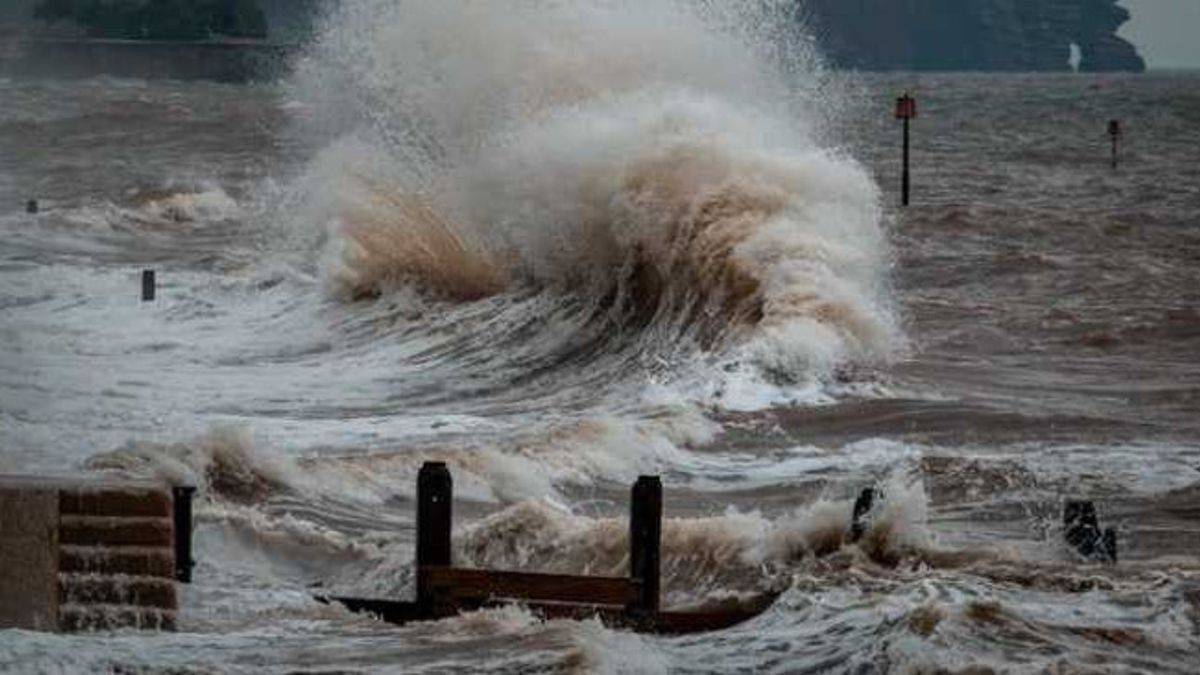
Moderate to heavy rain in a number of areas, including Banten, the Special Region of Jakarta, West Java, Central Java, the Special Region of Yogyakarta, and East Java. High waves (1.25-2.5 m) in the waters south of East Java to East Nusa Tenggara, the South Indian Ocean of East Java, the South Indian Ocean of Bali, the South Indian Ocean of West Nusa Tenggara, the South Indian Ocean of East Nusa Tenggara, the Sawu Sea, and the Arafura Sea.That's the explanation about Tropical Cyclone Narelle. Get other interesting news updates by visiting the VOI.id page.
The English, Chinese, Japanese, Arabic, and French versions are automatically generated by the AI. So there may still be inaccuracies in translating, please always see Indonesian as our main language. (system supported by DigitalSiber.id)
Most Popular Tags
#Prabowo Subianto #donald trump #Febrie Adriansyah #8791 #giias 2026Popular


