


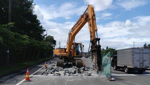
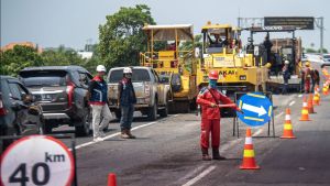
JAKARTA - PT Jasa Marga (Persero) Tbk (JSMR) through Jasamarga Metropolitan Tollroad (JMT) ensures that land disasters move in Pasirmunjul Village, Sukatani District, Purwakarta Regency, West Java, have no impact on the Cipularang Toll Road.
"Until now, the Cipularang Toll Road is safe to pass," said the Marketing and Communication Department Head of Jasamarga Metropolitan Tollroad Panji Satriya in a written statement, Tuesday, June 17.
In connection with information circulating regarding moving land in the area, said Panji, his party ensures that until now, the Cipularang Toll Road is safe to pass.
Based on air observations by the Jasamarga Tollroad Maintenance (JMTM) team as Jasa Marga's subsidiary who carries out toll road maintenance, the location of the nearby moving land is about 1 kilometer from the Cipularang Toll Road. Meanwhile, the direction of the ground moves north, so it does not intersect with the Cipularang Toll Road.
Even so, Panji continued, further studies must be carried out to prevent unwanted things.
Panji said, Jasamarga Metropolitan Tollroad (JMT) through Representative Office 3 continues to coordinate with the Purwakarta Regency Government, the West Java Regional Disaster Management Agency (BPBD) and the Public Works Office to jointly monitor if there is a shift in further land and the potential for impact on the Cipularang Toll Road.
"We guarantee the safety and comfort of road users while crossing the Cipularang Toll Road and will take anticipatory efforts to prevent the impact of damage to toll roads," he said.
Citing Antara's report, the land disaster in Purwakarta damaged 70 buildings. In detail, 57 houses were heavily damaged, one public facility was heavily damaged, one place of worship was heavily damaged, three houses were moderately damaged and eight houses were slightly damaged.
SEE ALSO:

BPBD Purwakarta noted that the land shift that occurred from June 11 to 14, 2025 had spread as far as 20 meters from the starting point. To date, affected residents have fled to the Pasirmunjul Village Office area, while others have chosen to temporarily stay at relatives' homes. The number of refugees was recorded at around 250 people.
The Geological Agency of the Ministry of Energy and Mineral Resources revealed that land disasters have occurred in the area several times, since Sunday, April 20 at 22.00 WIB, Wednesday, April 23 at 20.00 WIB, Monday, May 19 at 07.00 WIB, Wednesday, May 21 and Saturday, June 14.
In morphology, the disaster area which has a height of 370 meters above sea level is in the form of hills with a rather steep slope.
The English, Chinese, Japanese, Arabic, and French versions are automatically generated by the AI. So there may still be inaccuracies in translating, please always see Indonesian as our main language. (system supported by DigitalSiber.id)
Popular


