

JAKARTA - Israeli forces have shifted the 'yellow line' that marks their occupied territory in Gaza, approaching a road often used by Palestinians.
The Israel Defense Forces (IDF) pulled troops to the line under an October ceasefire, but Palestinians say the line has shifted forward since then.
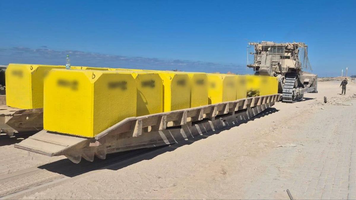
In recent days, Israeli forces have moved it west again by placing yellow blocks along Salah Al Din Street - the main route connecting the north and south of the Gaza Strip.
For thousands of Palestinians, the change has turned a vital route into a dangerous border.
Former construction worker Ramez Ishtaywi, 49, said there was "heavy and random gunfire against anyone who tried to get close."
The new line has destroyed the livelihood he had just built with his sons, which is collecting firewood east of Gaza City.
"We can still survive," he told The National, as quoted (29/4).
"Despite the occasional shots, we still stayed about 700 meters from the line," he said.
The situation changed overnight. When he arrived at work two days ago, he found tanks and military vehicles moving forward, placing a yellow concrete block right along Salah Al Din Street. The area where he worked was suddenly cut off.
The equipment he left behind is now unreachable.
"Our work has really come to a halt," he said.
"Crossing the line now is the same as suicide," he continued.
Meanwhile, for Ishtaywi, the loss was immediate: no jobs, no income, no alternatives. But the consequences go far beyond one livelihood.
Salah Al Din Road has long been Gaza's main corridor, a route that allows civilians to travel between the north and south more easily than the damaged and narrow coastal road.
For drivers, it's a functioning piece of infrastructure that's rare in a landscape that's largely destroyed.
Taxi driver Muneeb Abu Daher (32) started using the road shortly after the October ceasefire. At first, it felt like a breakthrough.
"It's faster and smoother," he told The National.
"It's better than the coastal road," he said.
Not long after, many drivers followed. The road became a vital route to transport passengers across the Gaza Strip. Even occasional gunfire did not stop them; the risk was considered manageable compared to other alternatives.
However, the recent change of the yellow line effectively closed the corridor.
"It creates confusion and makes everything more complicated," Abu Daher said.
Drivers were forced to return to the coastal road, which is damaged, narrow, and now very crowded. "The pressure on the road is very great," he said, noting the additional pressure from the bad coastal weather and deteriorating conditions.
For Gaza's already struggling transport sector, the change is another blow. Drivers are already dealing with soaring fuel costs, a shortage of engine oil, and damaged roads.
The loss of Salah Al Din Road removes one of the few remaining advantages.
"Every few days, something new happens," Abu Daher said.
"Right when we find a better way, it's taken away," he continued.
To note, the Yellow Line is a demarcation line that divides the territory into 47 percent under Palestinian control on the west side, as well as 57 percent under Israeli control, according to a map that is part of the peace plan in the Gaza Strip and the ceasefire announced October 2025.
This is not the first time that there have been reports of the shifting of the Yellow Line in Gaza by Israel into Palestinian territory.
For six months since the ceasefire, Israeli forces have shifted the agreed ceasefire line in Gaza to the west, expanding their control zone and making the precarious situation more dangerous for Palestinians, The Guardian reported last week.
The "yellow line" agreed to in the US-mediated ceasefire was supposed to be temporary pending further Israeli troop withdrawals, but the ceasefire, which was partially adhered to, stalled after its first phase amid disputes over Hamas disarmament, and Gaza's continued bombardment by Israel.
Since then, the yellow line has shifted forward in some places, expanding the military-held territory far beyond the 53 percent of Gaza implied in the original truce map.
According to the research institute Forensic Architecture, in December Israel had seized 58 percent of Gaza's territory and continued to advance.
The English, Chinese, Japanese, Arabic, and French versions are automatically generated by the AI. So there may still be inaccuracies in translating, please always see Indonesian as our main language. (system supported by DigitalSiber.id)
Most Popular Tags
#Prabowo Subianto #donald trump #Febrie Adriansyah #8791 #giias 2026Popular


