

JAKARTA - The Geological Agency of the Ministry of Energy and Mineral Resources (ESDM) reported an eruption of Mount Ibu, Halmahera Island, North Maluku, on Saturday, November 15, at midnight.
Geological Agency official M Saum Amin, in a statement in Jakarta on Saturday, stated that the incident occurred at 12:12 a.m. WIT.
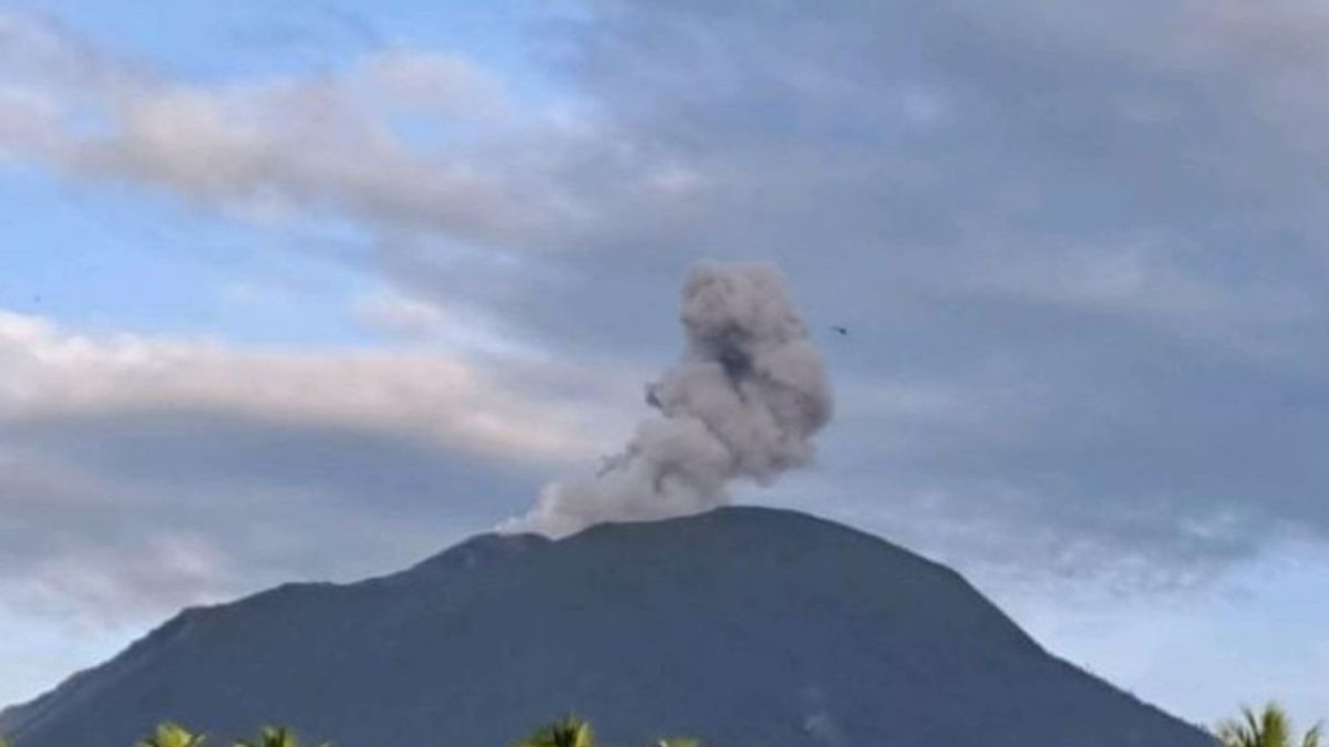
"The height of the eruption column was observed to be approximately 200 m above the summit (approximately 1,525 m above sea level)," said the statement, as quoted from the Magma Indonesia website in Jakarta on Saturday.
In his statement, Saum explained that the eruption emitted a column of ash that was observed to be white to gray in color with moderate to thick intensity, moving east and southeast.
He added that the eruptive activity was also clearly recorded by seismographs, with a maximum amplitude of 20 mm and a duration of approximately 40 seconds.
The Geological Agency urges residents around Mount Ibu to remain vigilant and follow local government directives, given the potential danger of further eruptions.
Residents in the surrounding area and visitors/tourists are advised to avoid activities within a two-kilometer radius and a 3.5-kilometer sectoral extension towards the crater opening in the northern part of Mount Ibu's active crater.
If ashfall occurs, Saum said, people conducting outdoor activities are advised to wear nose, mouth, and eye protection (goggles).
"All parties must maintain a conducive atmosphere in the community, refrain from spreading false narratives (hoaxes), and refrain from being provoked by issues of unknown origin," he said.
The public is also urged to always follow local government directives.
The West Halmahera Regency Government is expected to continuously coordinate with the Center for Volcanology and Geological Hazard Mitigation in Bandung, West Java, or with the Mount Ibu Observation Post in Gam Ici to obtain direct information on the latest eruption activity.
Indonesia is located in the Pacific Ring of Fire, an area with the highest levels of seismic and volcanic activity in the world.
Indonesia's position is at the meeting point of several major tectonic plates: the Indo-Australian Plate to the south, the Eurasian Plate to the north, and the Pacific Plate to the east.
The movement and collision of these plates, through a process called subduction, causes the formation of a series of volcanic arcs and triggers frequent earthquakes in Indonesia.
The English, Chinese, Japanese, Arabic, and French versions are automatically generated by the AI. So there may still be inaccuracies in translating, please always see Indonesian as our main language. (system supported by DigitalSiber.id)


